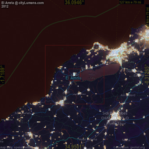
El Amria night lights from space
Night Light of El Amria (Aïn Témouchent) from space (Algeria) Src. Average luminocity for 10x10km area is 8.0275% and for 50x50km: 7.4544%.
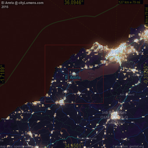
Analysis of El Amria night lights 2016
Square area 10x10 km:
 1.1%
1.1%90-99
0.92%80-89
0.92%70-79
0%60-69
0.73%50-59
0.73%40-49
2.38%30-39
2.38%20-29
1.83%10-19
0%0-9
89.01%Square area 50x50 km:
0.55%90-99
0.76%80-89
1.69%70-79
0.66%60-69
1.19%50-59
0.66%40-49
0.92%30-39
1.63%20-29
1.61%10-19
3.97%0-9
86.36%Clear (daylight) street map image can be seen on geolist.org.
Map coordinates:
36° 5' 40.6" North, 1° 43' 8" West
35° 31' 27.8" North, 1° 0' 56.8" West
34° 57' 0.4" North, 0° 18' 45.5" West
Some cities around El Amria sort by population:
• Oran
39.5 km =24.5 mi,  60°
60°
• Es Senia
38 km =23.6 mi,  68°
68°
• Aïn Temouchent
27.6 km =17.1 mi,  204°
204°
• ’Aïn el Turk
33 km =20.5 mi,  42°
42°
• Hammam Bou Hadjar
16.8 km =10.4 mi,  164°
164°
• Bou Tlelis
11.8 km =7.3 mi, 62°
• Mers el Kebir
35.9 km =22.3 mi,  50°
50°
• El Malah
16.3 km =10.1 mi,  205°
205°
2498704 (p: 26,407)
Sources (retrieved 2019-11-25):
» Earth at Night: Flat Maps 2012, 2016