Smørumnedre night lights from space
Night Light of Smørumnedre (Capital Region) from space (Denmark) Src. Average luminocity for 10x10km area is 28.0933% and for 50x50km: 23.2252%.
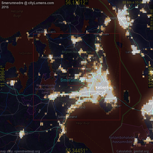
Analysis of Smørumnedre night lights 2016
Square area 10x10 km:
 4.55%
4.55%90-99
5.5%80-89
1.91%70-79
3.47%60-69
2.75%50-59
2.63%40-49
2.99%30-39
3.95%20-29
15.55%10-19
18.66%0-9
38.04%Square area 50x50 km:
5.88%90-99
5.39%80-89
2.32%70-79
2%60-69
2.06%50-59
2.13%40-49
2.18%30-39
2.52%20-29
5.09%10-19
13.73%0-9
56.69%Clear (daylight) street map image can be seen on geolist.org.
Map coordinates:
56° 8' 10" North, 11° 35' 58.7" East
55° 44' 32.4" North, 12° 18' 9.9" East
55° 20' 40.2" North, 13° 0' 21.2" East
Some cities around Smørumnedre sort by population:
• Ballerup
4 km =2.5 mi,  107°
107°
• Taastrup
10.3 km =6.4 mi,  180°
180°
• Albertslund
10.2 km =6.3 mi,  158°
158°
• Stenløse
7.2 km =4.5 mi,  293°
293°
• Farum
8.2 km =5.1 mi,  26°
26°
• Værløse
6.1 km =3.8 mi,  42°
42°
• Måløv
1.9 km =1.2 mi, 41°
• Stavnsholt
10.3 km =6.4 mi, 38°
2613345 (p: 9,507)
Sources (retrieved 2019-11-25):
» Earth at Night: Flat Maps 2012, 2016