Wietmarschen night lights from space
Night Light of Wietmarschen (Lower Saxony) from space (Germany) Src. Average luminocity for 10x10km area is 0.1984% and for 50x50km: 3.7812%.
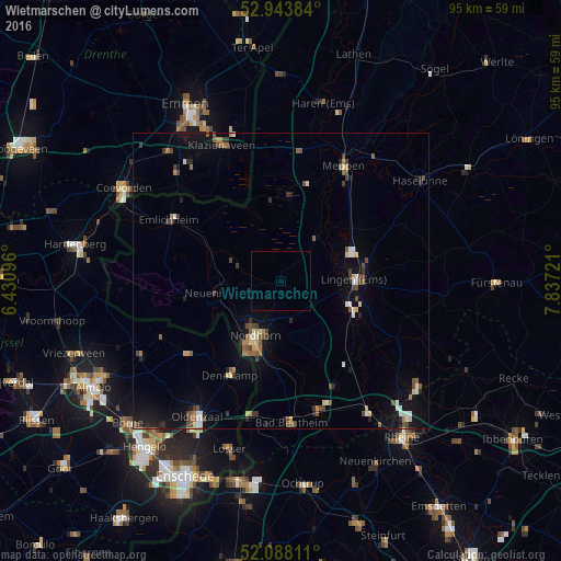
Analysis of Wietmarschen night lights 2016
Square area 10x10 km:
 0%
0%90-99
0%80-89
0%70-79
0%60-69
0%50-59
0%40-49
0%30-39
0%20-29
0%10-19
0%0-9
100%Square area 50x50 km:
0.34%90-99
0.45%80-89
0.35%70-79
0.3%60-69
0.43%50-59
0.66%40-49
0.76%30-39
0.73%20-29
0.56%10-19
2.47%0-9
92.95%Clear (daylight) street map image can be seen on geolist.org.
Map coordinates:
52° 56' 37.8" North, 6° 25' 51.5" East
52° 31' 5" North, 7° 8' 2.7" East
52° 5' 17.2" North, 7° 50' 14" East
Some cities around Wietmarschen sort by population:
• Nordhorn
10.7 km =6.6 mi,  204°
204°
• Lingen
12.5 km =7.8 mi,  88°
88°
• Meppen
21.9 km =13.6 mi,  28°
28°
• Geeste
12.8 km =8 mi,  44°
44°
• Emsbüren
17.3 km =10.7 mi,  139°
139°
• Lohne
6.6 km =4.1 mi,  109°
109°
• Emlichheim
22.1 km =13.7 mi,  299°
299°
• Uelsen
17.1 km =10.6 mi,  263°
263°
2809100 (p: 10,903)
Sources (retrieved 2019-11-25):
» Earth at Night: Flat Maps 2012, 2016