Weßling night lights from space
Night Light of Weßling (Bavaria) from space (Germany) Src. Average luminocity for 10x10km area is 7.6364% and for 50x50km: 11.7818%.
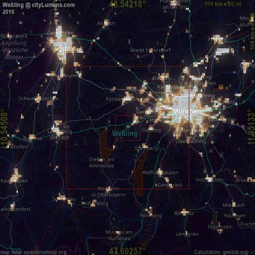
Analysis of Weßling night lights 2016
Square area 10x10 km:
 0.71%
0.71%90-99
1.28%80-89
1.14%70-79
0.57%60-69
0.85%50-59
1.42%40-49
1.7%30-39
0.85%20-29
1.14%10-19
2.27%0-9
88.07%Square area 50x50 km:
2.34%90-99
2.11%80-89
1.22%70-79
1.1%60-69
1.65%50-59
1.75%40-49
1.39%30-39
1.57%20-29
3.12%10-19
6.7%0-9
77.05%Clear (daylight) street map image can be seen on geolist.org.
Map coordinates:
48° 32' 31.8" North, 10° 32' 42.3" East
48° 4' 28.3" North, 11° 14' 53.5" East
47° 36' 9.3" North, 11° 57' 4.8" East
Some cities around Weßling sort by population:
• Fürstenfeldbruck
11.6 km =7.2 mi,  2°
2°
• Starnberg
10.8 km =6.7 mi,  138°
138°
• Puchheim
11.3 km =7 mi,  42°
42°
• Gauting
9.6 km =6 mi,  93°
93°
• Gilching
5 km =3.1 mi, 42°
• Eichenau
11.4 km =7.1 mi,  26°
26°
• Herrsching am Ammersee
9.9 km =6.2 mi,  212°
212°
• Seefeld
5.1 km =3.2 mi, 210°
2810587 (p: 5,172)
Sources (retrieved 2019-11-25):
» Earth at Night: Flat Maps 2012, 2016