Waldshut-Tiengen night lights from space
Night Light of Waldshut-Tiengen (Baden-Württemberg) from space (Germany) Src. Average luminocity for 10x10km area is 8.3006% and for 50x50km: 7.1481%.
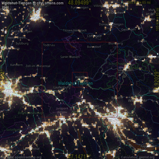
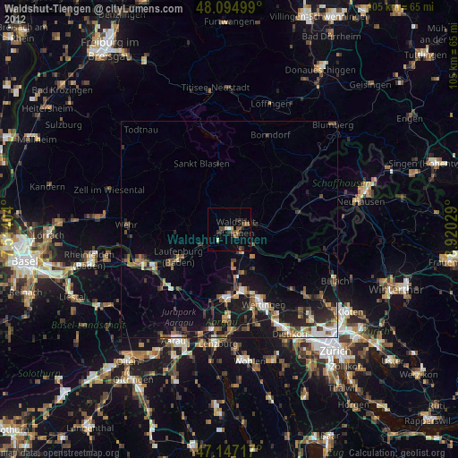
Analysis of Waldshut-Tiengen night lights 2016
Square area 10x10 km:
 0.45%
0.45%90-99
0.3%80-89
1.04%70-79
2.68%60-69
1.04%50-59
0.74%40-49
1.79%30-39
0.15%20-29
2.98%10-19
0.45%0-9
88.39%Square area 50x50 km:
0.81%90-99
0.98%80-89
0.63%70-79
0.62%60-69
0.82%50-59
1.14%40-49
1.2%30-39
1.17%20-29
1.96%10-19
7.59%0-9
83.08%Clear (daylight) street map image can be seen on geolist.org.
Map coordinates:
48° 5' 42" North, 7° 30' 50.5" East
47° 37' 23.6" North, 8° 13' 1.8" East
47° 8' 49.8" North, 8° 55' 13" East
Some cities around Waldshut-Tiengen sort by population:
• Brugg, CH
15.8 km =9.8 mi,  182°
182°
• Laufenburg
13.4 km =8.3 mi,  241°
241°
• Staufen
14.9 km =9.3 mi,  358°
358°
• Lauchringen
7.3 km =4.5 mi,  86°
86°
• Albbruck
7.5 km =4.7 mi, 241°
• Wutöschingen
12 km =7.5 mi,  69°
69°
• Untersiggenthal, CH
13.8 km =8.6 mi,  167°
167°
• Ühlingen-Birkendorf
12.8 km =8 mi,  35°
35°
2814791 (p: 22,404)
Sources (retrieved 2019-11-25):
» Earth at Night: Flat Maps 2012, 2016