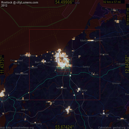
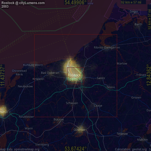
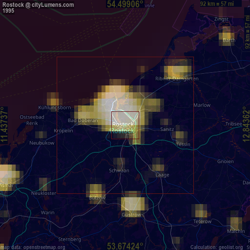
Rostock night lights from space
Night Light of Rostock (Mecklenburg-Vorpommern) from space (Germany) Src. Average luminocity for 10x10km area is 62.1919% and for 50x50km: 5.4153%.
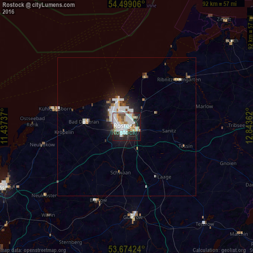
Analysis of Rostock night lights 2016
Square area 10x10 km:
 18.69%
90-99
21.09%80-89
6.69%70-79
3.91%60-69
3.79%50-59
3.66%40-49
5.68%30-39
3.03%20-29
16.79%10-19
14.65%0-9
2.02%Square area 50x50 km:
1.43%90-99
1.48%80-89
0.42%70-79
0.25%60-69
0.39%50-59
0.48%40-49
0.53%30-39
0.33%20-29
1.59%10-19
2.94%0-9
90.16%Clear (daylight) street map image can be seen on geolist.org.
Map coordinates:
54° 29' 56.6" North, 11° 26' 14.5" East
54° 5' 19.3" North, 12° 8' 25.8" East
53° 40' 27.3" North, 12° 50' 37" East
Some cities around Rostock sort by population:
• Ribnitz-Damgarten
26.7 km =16.6 mi,  50°
50°
• Bad Doberan
15.8 km =9.8 mi,  277°
277°
• Dierkow-Neu
2.6 km =1.6 mi,  42°
42°
• Warnemünde
10.5 km =6.5 mi,  339°
339°
• Bützow
28.7 km =17.8 mi,  201°
201°
• Ostseebad Kühlungsborn
25.7 km =16 mi,  285°
285°
• Satow-Oberhagen
19.7 km =12.2 mi,  238°
238°
• Schwaan
16.6 km =10.3 mi,  187°
187°
2844588 (p: 198,293)
Sources (retrieved 2019-11-25):
» NASA, Earths city lights 1995
» NASA city lights 2003
» Earth at Night: Flat Maps 2012, 2016