Reutlingen night lights from space
Night Light of Reutlingen (Baden-Württemberg) from space (Germany) Src. Average luminocity for 10x10km area is 37.2614% and for 50x50km: 12.6324%.

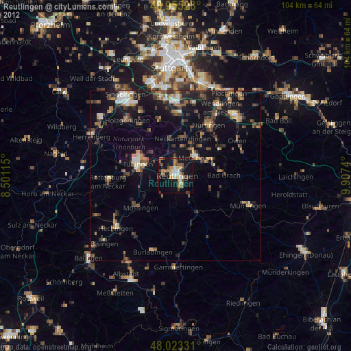
Analysis of Reutlingen night lights 2016
Square area 10x10 km:
 5.4%
5.4%90-99
6.25%80-89
4.83%70-79
4.26%60-69
5.54%50-59
5.68%40-49
3.55%30-39
4.26%20-29
8.52%10-19
43.61%0-9
8.1%Square area 50x50 km:
1.17%90-99
1.66%80-89
1.36%70-79
1.29%60-69
1.77%50-59
1.71%40-49
1.76%30-39
2.08%20-29
4.39%10-19
12.9%0-9
69.92%Clear (daylight) street map image can be seen on geolist.org.
Map coordinates:
48° 57' 19" North, 8° 30' 4.1" East
48° 29' 29.2" North, 9° 12' 15.4" East
48° 1' 23.9" North, 9° 54' 26.6" East
Some cities around Reutlingen sort by population:
• Metzingen
7.7 km =4.8 mi,  48°
48°
• Pfullingen
3.5 km =2.2 mi,  149°
149°
• Eningen unter Achalm
4.1 km =2.5 mi,  97°
97°
• Pliezhausen
7.6 km =4.7 mi,  1°
1°
• Unterhausen
7.8 km =4.8 mi, 151°
• Kusterdingen
7.1 km =4.4 mi,  299°
299°
• Kirchentellinsfurt
6.3 km =3.9 mi,  317°
317°
• Wannweil
4.9 km =3 mi,  305°
305°
2847736 (p: 112,627)
Sources (retrieved 2019-11-25):
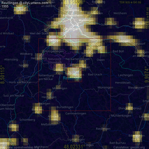
» NASA, Earths city lights 1995
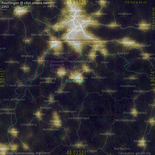
» NASA city lights 2003
» Earth at Night: Flat Maps 2012, 2016