Neuenburg am Rhein night lights from space
Night Light of Neuenburg am Rhein (Baden-Württemberg) from space (Germany) Src. Average luminocity for 10x10km area is 21.9509% and for 50x50km: 17.5637%.
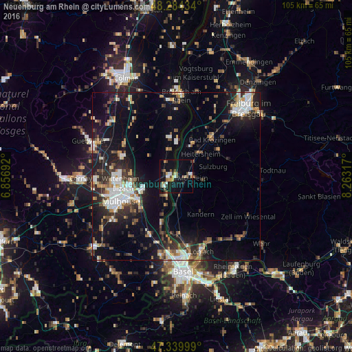
Analysis of Neuenburg am Rhein night lights 2016
Square area 10x10 km:
 2.68%
2.68%90-99
3.13%80-89
2.08%70-79
2.23%60-69
3.57%50-59
3.72%40-49
2.38%30-39
2.98%20-29
2.68%10-19
23.96%0-9
50.6%Square area 50x50 km:
3.1%90-99
2.87%80-89
1.27%70-79
1.9%60-69
1.75%50-59
2.16%40-49
2.26%30-39
2.93%20-29
5.02%10-19
13.63%0-9
63.12%Clear (daylight) street map image can be seen on geolist.org.
Map coordinates:
48° 17' 3.6" North, 6° 51' 24.9" East
47° 48' 51.5" North, 7° 33' 36.2" East
47° 20' 24" North, 8° 15' 47.4" East
Some cities around Neuenburg am Rhein sort by population:
• Müllheim
5.3 km =3.3 mi,  97°
97°
• Unterkrozingen
15.2 km =9.4 mi,  39°
39°
• Rixheim, FR
13.8 km =8.6 mi,  238°
238°
• Riedisheim, FR
16.2 km =10.1 mi, 243°
• Kandern
13.5 km =8.4 mi,  145°
145°
• Sausheim, FR
14.3 km =8.9 mi,  257°
257°
• Heitersheim
9.9 km =6.2 mi,  47°
47°
• Schliengen
6.5 km =4 mi,  169°
169°
2865813 (p: 11,682)
Sources (retrieved 2019-11-25):
» Earth at Night: Flat Maps 2012, 2016