Meßkirch night lights from space
Night Light of Meßkirch (Baden-Württemberg) from space (Germany) Src. Average luminocity for 10x10km area is 0.3466% and for 50x50km: 2.0478%.
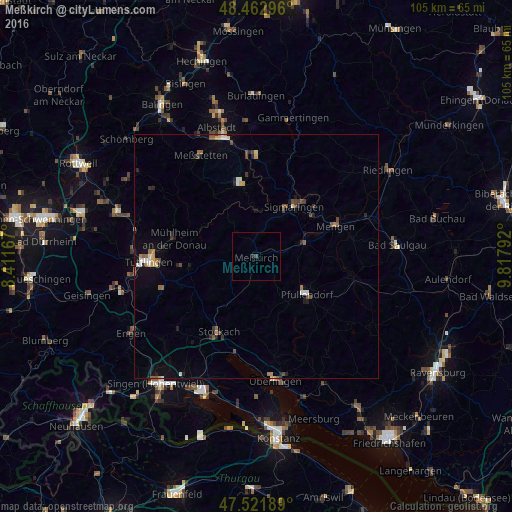
Analysis of Meßkirch night lights 2016
Square area 10x10 km:
 0%
0%90-99
0%80-89
0%70-79
0%60-69
0%50-59
0%40-49
0%30-39
0.57%20-29
0.57%10-19
0%0-9
98.86%Square area 50x50 km:
0.19%90-99
0.21%80-89
0.15%70-79
0.2%60-69
0.3%50-59
0.34%40-49
0.39%30-39
0.33%20-29
0.5%10-19
0.82%0-9
96.57%Clear (daylight) street map image can be seen on geolist.org.
Map coordinates:
48° 27' 46.7" North, 8° 24' 42" East
47° 59' 40.5" North, 9° 6' 53.2" East
47° 31' 18.8" North, 9° 49' 4.5" East
Some cities around Meßkirch sort by population:
• Stockach
17.8 km =11.1 mi,  206°
206°
• Sigmaringen
13.5 km =8.4 mi,  39°
39°
• Pfullendorf
13.1 km =8.1 mi,  125°
125°
• Mengen
17.1 km =10.6 mi,  69°
69°
• Ostrach
20.6 km =12.8 mi,  103°
103°
• Winterlingen
21 km =13 mi,  0°
0°
• Stetten am Kalten Markt
14.7 km =9.1 mi,  349°
349°
• Krauchenwies
10.2 km =6.3 mi,  76°
76°
2871609 (p: 8,736)
Sources (retrieved 2019-11-25):
» Earth at Night: Flat Maps 2012, 2016