Geretsried night lights from space
Night Light of Geretsried (Bavaria) from space (Germany) Src. Average luminocity for 10x10km area is 6.4418% and for 50x50km: 3.9306%.
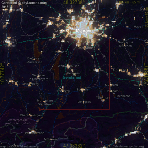
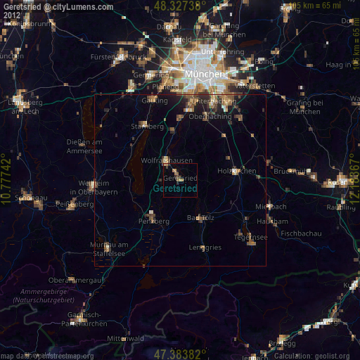
Analysis of Geretsried night lights 2016
Square area 10x10 km:
 0%
0%90-99
0%80-89
1.99%70-79
0.85%60-69
1.42%50-59
1.42%40-49
0.57%30-39
1.28%20-29
1.28%10-19
0.99%0-9
90.2%Square area 50x50 km:
0.18%90-99
0.37%80-89
0.39%70-79
0.43%60-69
0.68%50-59
0.74%40-49
0.75%30-39
0.95%20-29
1.3%10-19
2.63%0-9
91.58%Clear (daylight) street map image can be seen on geolist.org.
Map coordinates:
48° 19' 38.6" North, 10° 46' 38.7" East
47° 51' 27.9" North, 11° 28' 49.9" East
47° 23' 1.8" North, 12° 11' 1.2" East
Some cities around Geretsried sort by population:
• Bad Tölz
12.2 km =7.6 mi,  151°
151°
• Wolfratshausen
7.5 km =4.7 mi,  324°
324°
• Penzberg
14 km =8.7 mi,  213°
213°
• Holzkirchen
16.6 km =10.3 mi,  82°
82°
• Tutzing
16 km =9.9 mi,  291°
291°
• Schäftlarn
14.8 km =9.2 mi,  352°
352°
• Dietramszell
8.6 km =5.3 mi,  96°
96°
• Egling
7.5 km =4.7 mi,  14°
14°
2921139 (p: 23,364)
Sources (retrieved 2019-11-25):
» Earth at Night: Flat Maps 2012, 2016