Genthin night lights from space
Night Light of Genthin (Saxony-Anhalt) from space (Germany) Src. Average luminocity for 10x10km area is 4.6705% and for 50x50km: 2.3549%.
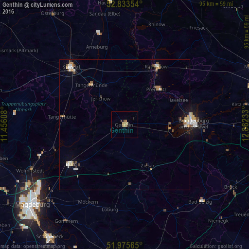
Analysis of Genthin night lights 2016
Square area 10x10 km:
 0%
0%90-99
0.51%80-89
0.63%70-79
1.77%60-69
0.63%50-59
1.01%40-49
1.01%30-39
0%20-29
0.51%10-19
0.51%0-9
93.43%Square area 50x50 km:
0.23%90-99
0.42%80-89
0.28%70-79
0.37%60-69
0.31%50-59
0.33%40-49
0.35%30-39
0.19%20-29
0.17%10-19
0.92%0-9
96.44%Clear (daylight) street map image can be seen on geolist.org.
Map coordinates:
52° 50' 0.7" North, 11° 27' 21.9" East
52° 24' 24" North, 12° 9' 33.1" East
51° 58' 32.3" North, 12° 51' 44.4" East
Some cities around Genthin sort by population:
• Brandenburg an der Havel
26.5 km =16.5 mi,  87°
87°
• Stendal
30.2 km =18.8 mi,  317°
317°
• Rathenow
25.3 km =15.7 mi,  28°
28°
• Burg bei Magdeburg
25.6 km =15.9 mi,  233°
233°
• Premnitz
18.9 km =11.7 mi,  42°
42°
• Tangermünde
19.7 km =12.2 mi, 321°
• Möckern
32.7 km =20.3 mi,  205°
205°
• Tangerhütte
24.1 km =15 mi,  277°
277°
2921309 (p: 14,059)
Sources (retrieved 2019-11-25):
» Earth at Night: Flat Maps 2012, 2016