Gadebusch night lights from space
Night Light of Gadebusch (Mecklenburg-Vorpommern) from space (Germany) Src. Average luminocity for 10x10km area is 0% and for 50x50km: 3.4262%.
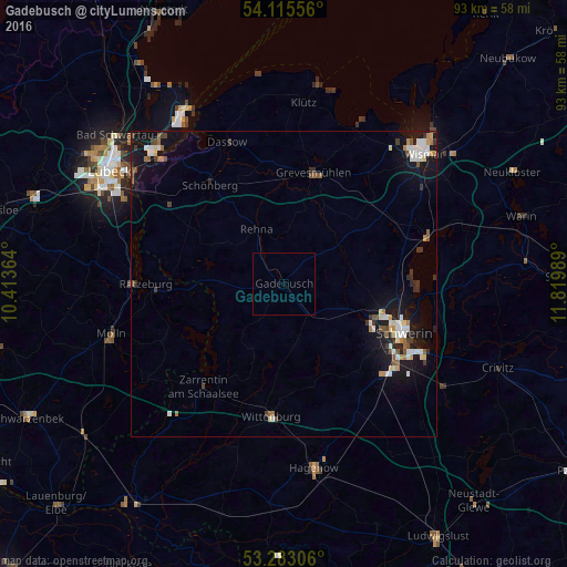
Analysis of Gadebusch night lights 2016
Square area 10x10 km:
 0%
0%90-99
0%80-89
0%70-79
0%60-69
0%50-59
0%40-49
0%30-39
0%20-29
0%10-19
0%0-9
100%Square area 50x50 km:
0.46%90-99
0.72%80-89
0.28%70-79
0.2%60-69
0.39%50-59
0.4%40-49
0.41%30-39
0.5%20-29
0.48%10-19
3.85%0-9
92.3%Clear (daylight) street map image can be seen on geolist.org.
Map coordinates:
54° 6' 56" North, 10° 24' 49.1" East
53° 42' 4.9" North, 11° 7' 0.3" East
53° 16' 59" North, 11° 49' 11.6" East
Some cities around Gadebusch sort by population:
• Schwerin
21.1 km =13.1 mi,  112°
112°
• Mölln
29.8 km =18.5 mi,  251°
251°
• Ratzeburg
22.7 km =14.1 mi,  269°
269°
• Weststadt
19.8 km =12.3 mi, 111°
• Grevesmühlen
18.7 km =11.6 mi,  15°
15°
• Lankow
17.6 km =10.9 mi, 109°
• Paulsstadt
20.4 km =12.7 mi, 111°
• Wittenburg
21.9 km =13.6 mi,  186°
186°
2923410 (p: 6,030)
Sources (retrieved 2019-11-25):
» Earth at Night: Flat Maps 2012, 2016