Fuhlsbüttel night lights from space
Night Light of Fuhlsbüttel (Hamburg) from space (Germany) Src. Average luminocity for 10x10km area is 77.1326% and for 50x50km: 25.1243%.
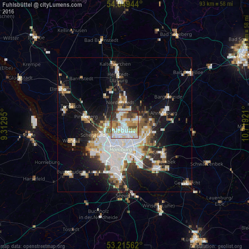
Analysis of Fuhlsbüttel night lights 2016
Square area 10x10 km:
 23.86%
90-99
23.48%80-89
6.44%70-79
8.71%60-69
14.52%50-59
4.67%40-49
6.31%30-39
7.32%20-29
4.67%10-19
0%0-9
0%Square area 50x50 km:
7.31%90-99
5.61%80-89
1.68%70-79
2.17%60-69
2.82%50-59
2.39%40-49
2.84%30-39
2.46%20-29
4.69%10-19
12.08%0-9
55.95%Clear (daylight) street map image can be seen on geolist.org.
Map coordinates:
54° 2' 58" North, 9° 18' 46.6" East
53° 38' 4.5" North, 10° 0' 57.9" East
53° 12' 56.2" North, 10° 43' 9.2" East
Some cities around Fuhlsbüttel sort by population:
• Winterhude
4 km =2.5 mi,  195°
195°
• Langenhorn
3.6 km =2.2 mi,  0°
0°
• Barmbek-Nord
3.6 km =2.2 mi,  154°
154°
• Steilshoop
3.9 km =2.4 mi,  133°
133°
• Hummelsbüttel
2.2 km =1.4 mi,  48°
48°
• Ohlsdorf
1.4 km =0.9 mi, 133°
• Alsterdorf
2.6 km =1.6 mi,  184°
184°
• Wellingsbüttel
4.3 km =2.7 mi,  80°
80°
2923850 (p: 11,995)
Sources (retrieved 2019-11-25):
» Earth at Night: Flat Maps 2012, 2016