Elsterwerda night lights from space
Night Light of Elsterwerda (Brandenburg) from space (Germany) Src. Average luminocity for 10x10km area is 2.3676% and for 50x50km: 2.1486%.
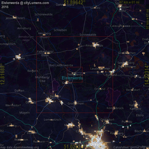
Analysis of Elsterwerda night lights 2016
Square area 10x10 km:
 0%
0%90-99
0%80-89
0.4%70-79
0.4%60-69
0.53%50-59
0.53%40-49
0.13%30-39
0.94%20-29
0.53%10-19
1.07%0-9
95.45%Square area 50x50 km:
0.19%90-99
0.3%80-89
0.21%70-79
0.31%60-69
0.44%50-59
0.27%40-49
0.35%30-39
0.26%20-29
0.22%10-19
0.5%0-9
96.94%Clear (daylight) street map image can be seen on geolist.org.
Map coordinates:
51° 53' 47.1" North, 12° 49' 0.8" East
51° 27' 37.5" North, 13° 31' 12" East
51° 1' 12.9" North, 14° 13' 23.3" East
Some cities around Elsterwerda sort by population:
• Riesa
23.2 km =14.4 mi,  223°
223°
• Lauchhammer
17.3 km =10.7 mi,  79°
79°
• Finsterwalde
23.2 km =14.4 mi,  33°
33°
• Großenhain
19 km =11.8 mi,  177°
177°
• Bad Liebenwerda
10.8 km =6.7 mi,  306°
306°
• Doberlug-Kirchhain
18.6 km =11.6 mi,  9°
9°
• Nünchritz
20.1 km =12.5 mi,  207°
207°
• Zeithain
18.9 km =11.7 mi, 221°
2930680 (p: 9,694)
Sources (retrieved 2019-11-25):
» Earth at Night: Flat Maps 2012, 2016