Bad Liebenwerda night lights from space
Night Light of Bad Liebenwerda (Brandenburg) from space (Germany) Src. Average luminocity for 10x10km area is 0.0775% and for 50x50km: 1.7691%.
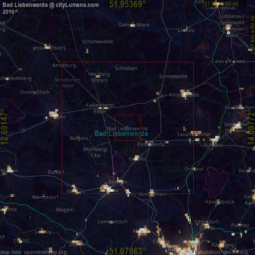
Analysis of Bad Liebenwerda night lights 2016
Square area 10x10 km:
 0%
0%90-99
0%80-89
0%70-79
0%60-69
0%50-59
0%40-49
0%30-39
0%20-29
0%10-19
0.53%0-9
99.47%Square area 50x50 km:
0.16%90-99
0.25%80-89
0.18%70-79
0.26%60-69
0.42%50-59
0.3%40-49
0.23%30-39
0.19%20-29
0.2%10-19
0.42%0-9
97.39%Clear (daylight) street map image can be seen on geolist.org.
Map coordinates:
51° 57' 13.3" North, 12° 41' 29.3" East
51° 31' 5.7" North, 13° 23' 40.5" East
51° 4' 43.1" North, 14° 5' 51.8" East
Some cities around Bad Liebenwerda sort by population:
• Riesa
24.5 km =15.2 mi,  196°
196°
• Herzberg
22.3 km =13.9 mi,  327°
327°
• Doberlug-Kirchhain
16.7 km =10.4 mi,  44°
44°
• Elsterwerda
10.8 km =6.7 mi,  126°
126°
• Falkenberg
12.9 km =8 mi,  305°
305°
• Nünchritz
24.3 km =15.1 mi,  181°
181°
• Zeithain
20.9 km =13 mi,  190°
190°
• Belgern
19.2 km =11.9 mi,  258°
258°
2953408 (p: 10,890)
Sources (retrieved 2019-11-25):
» Earth at Night: Flat Maps 2012, 2016