Gersthofen night lights from space
Night Light of Gersthofen (Bavaria) from space (Germany) Src. Average luminocity for 10x10km area is 48.7912% and for 50x50km: 6.8657%.
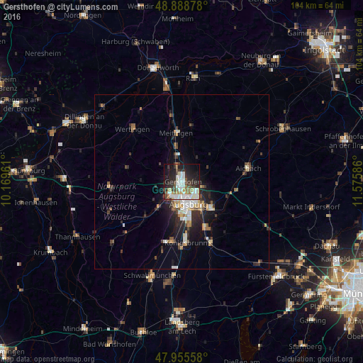
Analysis of Gersthofen night lights 2016
Square area 10x10 km:
 14.77%
90-99
11.51%80-89
3.13%70-79
3.84%60-69
4.69%50-59
3.13%40-49
6.11%30-39
6.39%20-29
16.34%10-19
23.15%0-9
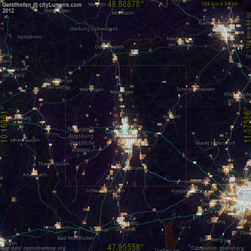
6.96%Square area 50x50 km:
1.15%90-99
1.17%80-89
0.67%70-79
0.6%60-69
0.81%50-59
0.69%40-49
0.98%30-39
1.19%20-29
2.5%10-19
4.18%0-9
86.08%Clear (daylight) street map image can be seen on geolist.org.
Map coordinates:
48° 53' 19.6" North, 10° 10' 10.6" East
48° 25' 27.6" North, 10° 52' 21.8" East
47° 57' 20.1" North, 11° 34' 33.1" East
Some cities around Gersthofen sort by population:
• Augsburg
6.2 km =3.9 mi,  162°
162°
• Friedberg
11.2 km =7 mi,  132°
132°
• Stadtbergen
6.7 km =4.2 mi,  196°
196°
• Meitingen
13.6 km =8.5 mi,  353°
353°
• Diedorf
10.4 km =6.5 mi,  220°
220°
• Langweid
7.5 km =4.7 mi, 348°
• Dasing
13.6 km =8.5 mi,  108°
108°
• Affing
9.4 km =5.8 mi,  60°
60°
2920891 (p: 20,254)
Sources (retrieved 2019-11-25):
» Earth at Night: Flat Maps 2012, 2016