Dahme night lights from space
Night Light of Dahme (Brandenburg) from space (Germany) Src. Average luminocity for 10x10km area is 1.375% and for 50x50km: 0.6804%.
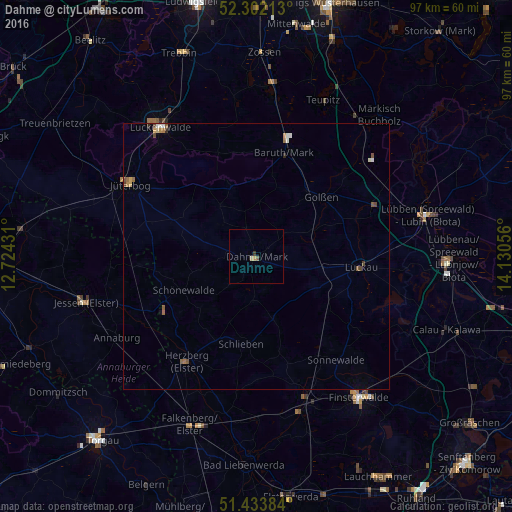
Analysis of Dahme night lights 2016
Square area 10x10 km:
 0%
0%90-99
0%80-89
0.51%70-79
0.25%60-69
0.25%50-59
0.25%40-49
0.25%30-39
0.51%20-29
0%10-19
0%0-9
97.98%Square area 50x50 km:
0.04%90-99
0.11%80-89
0.06%70-79
0.12%60-69
0.15%50-59
0.15%40-49
0.17%30-39
0.05%20-29
0.04%10-19
0.04%0-9
99.08%Clear (daylight) street map image can be seen on geolist.org.
Map coordinates:
52° 18' 7.7" North, 12° 43' 27.5" East
51° 52' 12.3" North, 13° 25' 38.7" East
51° 26' 1.8" North, 14° 7' 50" East
Some cities around Dahme sort by population:
• Luckenwalde
30.3 km =18.8 mi,  324°
324°
• Finsterwalde
32.5 km =20.2 mi,  143°
143°
• Lübben
32.5 km =20.2 mi,  76°
76°
• Jüterbog
27.6 km =17.1 mi,  300°
300°
• Herzberg
24.9 km =15.5 mi,  214°
214°
• Luckau
19.3 km =12 mi,  95°
95°
• Doberlug-Kirchhain
28.7 km =17.8 mi,  161°
161°
• Niedergörsdorf
32.7 km =20.3 mi,  291°
291°
2939388 (p: 5,924)
Sources (retrieved 2019-11-25):
» Earth at Night: Flat Maps 2012, 2016