Crailsheim night lights from space
Night Light of Crailsheim (Baden-Württemberg) from space (Germany) Src. Average luminocity for 10x10km area is 15.5588% and for 50x50km: 1.7748%.
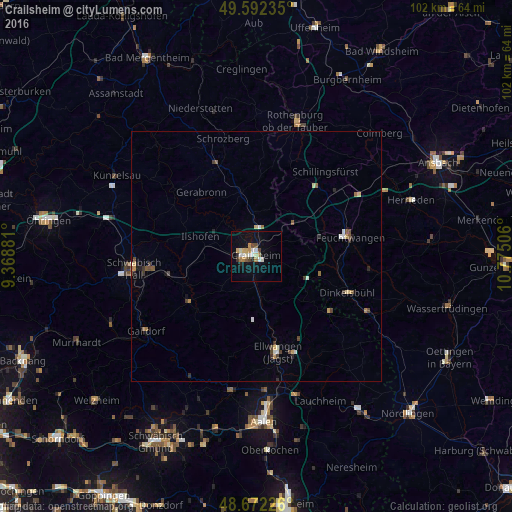
Analysis of Crailsheim night lights 2016
Square area 10x10 km:
 1.96%
1.96%90-99
2.8%80-89
1.82%70-79
2.66%60-69
1.96%50-59
0.56%40-49
2.1%30-39
0.84%20-29
1.54%10-19
8.96%0-9
74.79%Square area 50x50 km:
0.14%90-99
0.28%80-89
0.19%70-79
0.25%60-69
0.24%50-59
0.19%40-49
0.38%30-39
0.29%20-29
0.24%10-19
0.48%0-9
97.32%Clear (daylight) street map image can be seen on geolist.org.
Map coordinates:
49° 35' 32.5" North, 9° 22' 7.7" East
49° 8' 4" North, 10° 4' 18.9" East
48° 40' 20.1" North, 10° 46' 30.2" East
Some cities around Crailsheim sort by population:
• Schwäbisch Hall
24.4 km =15.2 mi,  263°
263°
• Ellwangen
19.7 km =12.2 mi,  167°
167°
• Feuchtwangen
19.6 km =12.2 mi,  80°
80°
• Dinkelsbühl
19.4 km =12.1 mi,  111°
111°
• Ilshofen
11.9 km =7.4 mi,  289°
289°
• Blaufelden
19.5 km =12.1 mi,  338°
338°
• Satteldorf
3.9 km =2.4 mi,  8°
8°
• Rot am See
13.5 km =8.4 mi, 342°
2939797 (p: 32,262)
Sources (retrieved 2019-11-25):
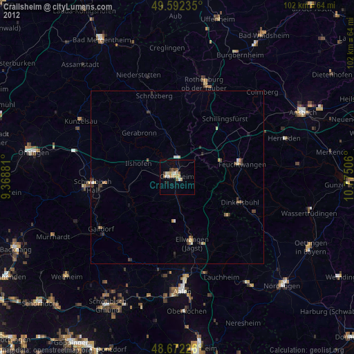
» Earth at Night: Flat Maps 2012, 2016