Burgau night lights from space
Night Light of Burgau (Bavaria) from space (Germany) Src. Average luminocity for 10x10km area is 6.983% and for 50x50km: 4.4347%.
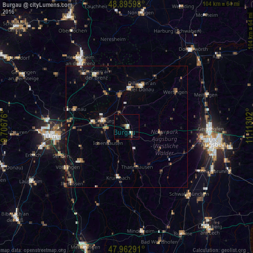
Analysis of Burgau night lights 2016
Square area 10x10 km:
 1.14%
1.14%90-99
1.14%80-89
0%70-79
1.28%60-69
0.99%50-59
0.28%40-49
1.7%30-39
0.57%20-29
0.71%10-19
1.56%0-9
90.63%Square area 50x50 km:
0.27%90-99
0.55%80-89
0.35%70-79
0.49%60-69
0.66%50-59
0.67%40-49
0.86%30-39
0.99%20-29
0.69%10-19
1.7%0-9
92.76%Clear (daylight) street map image can be seen on geolist.org.
Map coordinates:
48° 53' 45.5" North, 9° 42' 24.3" East
48° 25' 53.7" North, 10° 24' 35.6" East
47° 57' 46.5" North, 11° 6' 46.9" East
Some cities around Burgau sort by population:
• Günzburg
10.2 km =6.3 mi,  285°
285°
• Lauingen
15.2 km =9.4 mi,  4°
4°
• Ichenhausen
10.1 km =6.3 mi,  228°
228°
• Gundelfingen
13.8 km =8.6 mi,  348°
348°
• Jettingen-Scheppach
5.1 km =3.2 mi,  155°
155°
• Leipheim
14 km =8.7 mi,  278°
278°
• Zusmarshausen
14.4 km =8.9 mi,  104°
104°
• Sontheim an der Brenz
16 km =9.9 mi,  326°
326°
2941485 (p: 9,576)
Sources (retrieved 2019-11-25):
» Earth at Night: Flat Maps 2012, 2016