Bremerhaven night lights from space
Night Light of Bremerhaven (Bremen) from space (Germany) Src. Average luminocity for 10x10km area is 47.9577% and for 50x50km: 3.0704%.
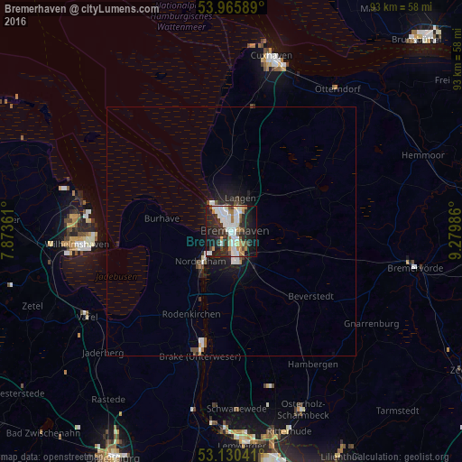
Analysis of Bremerhaven night lights 2016
Square area 10x10 km:
 13.36%
90-99
13.1%80-89
1.85%70-79
5.29%60-69
4.76%50-59
3.04%40-49
4.1%30-39
4.89%20-29
17.06%10-19
26.59%0-9
5.95%Square area 50x50 km:
0.7%90-99
0.69%80-89
0.13%70-79
0.25%60-69
0.24%50-59
0.23%40-49
0.39%30-39
0.3%20-29
1.02%10-19
2.46%0-9
93.6%Clear (daylight) street map image can be seen on geolist.org.
Map coordinates:
53° 57' 57.2" North, 7° 52' 25" East
53° 33' 0.8" North, 8° 34' 36.2" East
53° 7' 49.5" North, 9° 16' 47.5" East
Some cities around Bremerhaven sort by population:
• Nordenham
9.5 km =5.9 mi,  221°
221°
• Langen
6.3 km =3.9 mi,  11°
11°
• Loxstedt
10.5 km =6.5 mi,  152°
152°
• Brake (Unterweser)
24.9 km =15.5 mi,  194°
194°
• Schiffdorf
5.2 km =3.2 mi,  111°
111°
• Nordholz
26.2 km =16.3 mi, 5°
• Butjadingen
16 km =9.9 mi,  268°
268°
• Ovelgönne
25.3 km =15.7 mi,  203°
203°
2944368 (p: 117,446)
Sources (retrieved 2019-11-25):
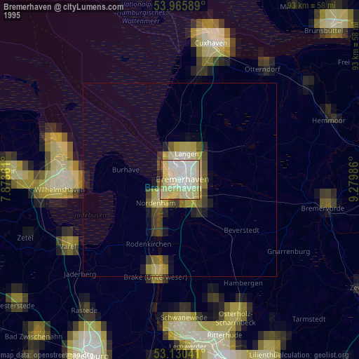
» NASA, Earths city lights 1995
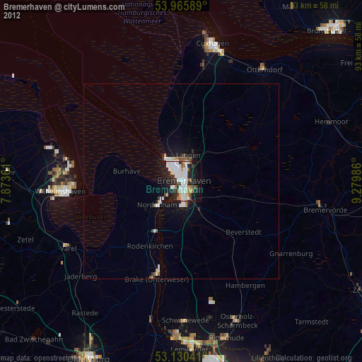
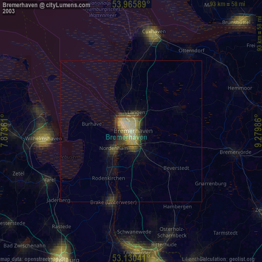
» NASA city lights 2003
» Earth at Night: Flat Maps 2012, 2016