Nordenham night lights from space
Night Light of Nordenham (Lower Saxony) from space (Germany) Src. Average luminocity for 10x10km area is 10.3175% and for 50x50km: 4.2642%.

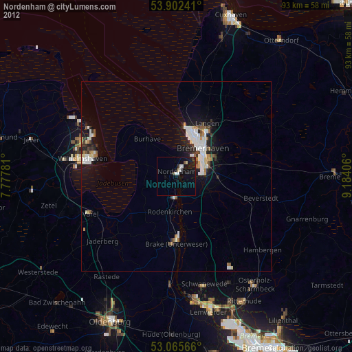
Analysis of Nordenham night lights 2016
Square area 10x10 km:
 1.85%
1.85%90-99
1.32%80-89
0.53%70-79
0.53%60-69
0.53%50-59
0.4%40-49
2.78%30-39
1.19%20-29
3.44%10-19
12.83%0-9
74.6%Square area 50x50 km:
0.87%90-99
0.95%80-89
0.24%70-79
0.4%60-69
0.3%50-59
0.35%40-49
0.53%30-39
0.38%20-29
1.4%10-19
3.49%0-9
91.09%Clear (daylight) street map image can be seen on geolist.org.
Map coordinates:
53° 54' 8.7" North, 7° 46' 40.1" East
53° 29' 10" North, 8° 28' 51.3" East
53° 3' 56.4" North, 9° 11' 2.6" East
Some cities around Nordenham sort by population:
• Bremerhaven
9.5 km =5.9 mi,  41°
41°
• Wilhelmshaven
24.8 km =15.4 mi,  281°
281°
• Langen
15.3 km =9.5 mi,  29°
29°
• Loxstedt
11.4 km =7.1 mi,  100°
100°
• Brake (Unterweser)
17 km =10.6 mi,  179°
179°
• Schiffdorf
12.4 km =7.7 mi,  64°
64°
• Butjadingen
11.8 km =7.3 mi,  305°
305°
• Ovelgönne
16.5 km =10.3 mi,  193°
193°
2862104 (p: 27,714)
Sources (retrieved 2019-11-25):
» Earth at Night: Flat Maps 2012, 2016