Bad Urach night lights from space
Night Light of Bad Urach (Baden-Württemberg) from space (Germany) Src. Average luminocity for 10x10km area is 5.081% and for 50x50km: 10.8704%.
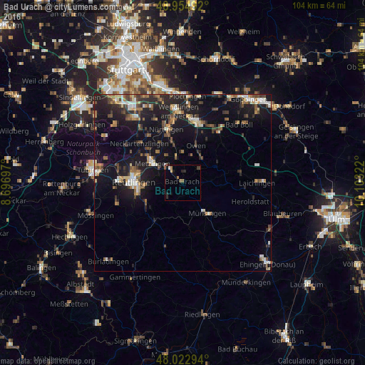
Analysis of Bad Urach night lights 2016
Square area 10x10 km:
 0.28%
0.28%90-99
0.43%80-89
0.85%70-79
0.14%60-69
1.56%50-59
0.43%40-49
0.85%30-39
0.43%20-29
2.56%10-19
0.85%0-9
91.62%Square area 50x50 km:
1.03%90-99
1.37%80-89
1.07%70-79
1.02%60-69
1.68%50-59
1.58%40-49
1.77%30-39
1.59%20-29
3.52%10-19
11.9%0-9
73.47%Clear (daylight) street map image can be seen on geolist.org.
Map coordinates:
48° 57' 17.7" North, 8° 41' 49.1" East
48° 29' 27.9" North, 9° 24' 0.3" East
48° 1' 22.6" North, 10° 6' 11.6" East
Some cities around Bad Urach sort by population:
• Metzingen
10 km =6.2 mi,  300°
300°
• Münsingen
11.4 km =7.1 mi,  141°
141°
• Eningen unter Achalm
10.4 km =6.5 mi,  267°
267°
• Dettingen an der Erms
6 km =3.7 mi,  317°
317°
• Frickenhausen
11.8 km =7.3 mi,  345°
345°
• Lenningen
8.7 km =5.4 mi,  40°
40°
• Neuffen
7.3 km =4.5 mi, 345°
• Sankt Johann
5.8 km =3.6 mi,  225°
225°
2818246 (p: 12,831)
Sources (retrieved 2019-11-25):
» Earth at Night: Flat Maps 2012, 2016