Žamberk night lights from space
Night Light of Žamberk (Pardubický) from space (Czech Republic) Src. Average luminocity for 10x10km area is 2.9146% and for 50x50km: 2.2397%.
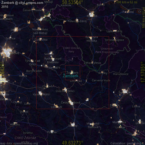
Analysis of Žamberk night lights 2016
Square area 10x10 km:
 0%
0%90-99
0.56%80-89
0.56%70-79
0.56%60-69
0.56%50-59
0%40-49
1.12%30-39
0%20-29
0.56%10-19
0%0-9
96.08%Square area 50x50 km:
0.32%90-99
0.45%80-89
0.23%70-79
0.34%60-69
0.32%50-59
0.14%40-49
0.26%30-39
0.19%20-29
0.29%10-19
0.12%0-9
97.34%Clear (daylight) street map image can be seen on geolist.org.
Map coordinates:
50° 32' 6.1" North, 15° 45' 51.3" East
50° 5' 9.6" North, 16° 28' 2.6" East
49° 37' 57.8" North, 17° 10' 13.8" East
Some cities around Žamberk sort by population:
• Česká Třebová
20.3 km =12.6 mi,  184°
184°
• Ústí nad Orlicí
13.5 km =8.4 mi,  202°
202°
• Vysoké Mýto
26.4 km =16.4 mi,  235°
235°
• Rychnov nad Kněžnou
16.2 km =10.1 mi,  301°
301°
• Lanškroun
21.9 km =13.6 mi,  151°
151°
• Choceň
19.8 km =12.3 mi, 241°
• Letohrad
6 km =3.7 mi,  158°
158°
• Kostelec nad Orlicí
18.6 km =11.6 mi,  282°
282°
3061888 (p: 6,082)
Sources (retrieved 2019-11-25):
» Earth at Night: Flat Maps 2012, 2016