Česká Třebová night lights from space
Night Light of Česká Třebová (Pardubický) from space (Czech Republic) Src. Average luminocity for 10x10km area is 10.6078% and for 50x50km: 2.173%.
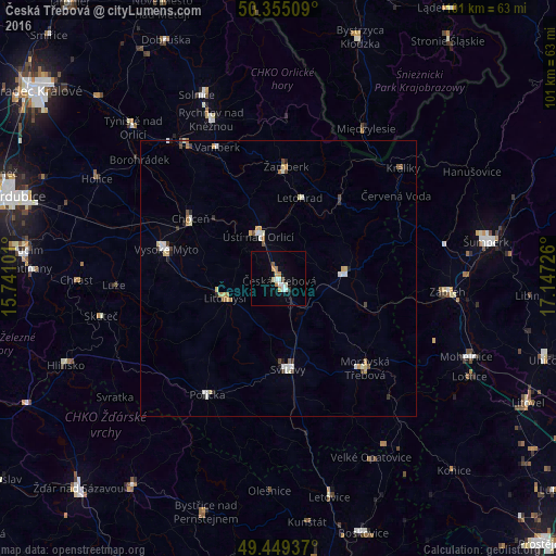
Analysis of Česká Třebová night lights 2016
Square area 10x10 km:
 1.82%
1.82%90-99
2.24%80-89
0.42%70-79
2.52%60-69
0.84%50-59
0.56%40-49
0.56%30-39
0.56%20-29
0%10-19
0.84%0-9
89.64%Square area 50x50 km:
0.32%90-99
0.46%80-89
0.28%70-79
0.29%60-69
0.26%50-59
0.13%40-49
0.26%30-39
0.22%20-29
0.2%10-19
0.12%0-9
97.46%Clear (daylight) street map image can be seen on geolist.org.
Map coordinates:
50° 21' 18.3" North, 15° 44' 27.6" East
49° 54' 15.7" North, 16° 26' 38.9" East
49° 26' 57.7" North, 17° 8' 50.1" East
Some cities around Česká Třebová sort by population:
• Svitavy
16.6 km =10.3 mi,  174°
174°
• Ústí nad Orlicí
8.5 km =5.3 mi,  334°
334°
• Vysoké Mýto
20.9 km =13 mi,  285°
285°
• Litomyšl
10.2 km =6.3 mi,  246°
246°
• Lanškroun
12 km =7.5 mi,  85°
85°
• Choceň
19.2 km =11.9 mi,  304°
304°
• Letohrad
15.1 km =9.4 mi,  14°
14°
• Žamberk
20.3 km =12.6 mi,  4°
4°
3077920 (p: 16,655)
Sources (retrieved 2019-11-25):
» Earth at Night: Flat Maps 2012, 2016