Jilemnice night lights from space
Night Light of Jilemnice (Liberecký kraj) from space (Czech Republic) Src. Average luminocity for 10x10km area is 2.262% and for 50x50km: 2.8522%.
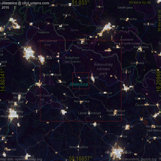
Analysis of Jilemnice night lights 2016
Square area 10x10 km:
 0%
0%90-99
0%80-89
0.4%70-79
1.2%60-69
0.53%50-59
0%40-49
0%30-39
0%20-29
1.07%10-19
0%0-9
96.79%Square area 50x50 km:
0.51%90-99
0.5%80-89
0.22%70-79
0.28%60-69
0.33%50-59
0.41%40-49
0.35%30-39
0.38%20-29
0.26%10-19
0.66%0-9
96.09%Clear (daylight) street map image can be seen on geolist.org.
Map coordinates:
51° 3' 10.8" North, 14° 48' 12.3" East
50° 36' 32" North, 15° 30' 23.5" East
50° 9' 38.1" North, 16° 12' 34.8" East
Some cities around Jilemnice sort by population:
• Jičín
22 km =13.7 mi,  209°
209°
• Vrchlabí
7.5 km =4.7 mi,  74°
74°
• Nová Paka
12.7 km =7.9 mi,  177°
177°
• Semily
12.1 km =7.5 mi,  266°
266°
• Szklarska Poręba, PL
24.1 km =15 mi,  2°
2°
• Tanvald
20.1 km =12.5 mi,  315°
315°
• Železný Brod
18.2 km =11.3 mi,  281°
281°
• Lomnice nad Popelkou
12.8 km =8 mi,  227°
227°
3074187 (p: 5,777)
Sources (retrieved 2019-11-25):
» Earth at Night: Flat Maps 2012, 2016