Bechyně night lights from space
Night Light of Bechyně (Jihočeský kraj) from space (Czech Republic) Src. Average luminocity for 10x10km area is 2.512% and for 50x50km: 2.6116%.
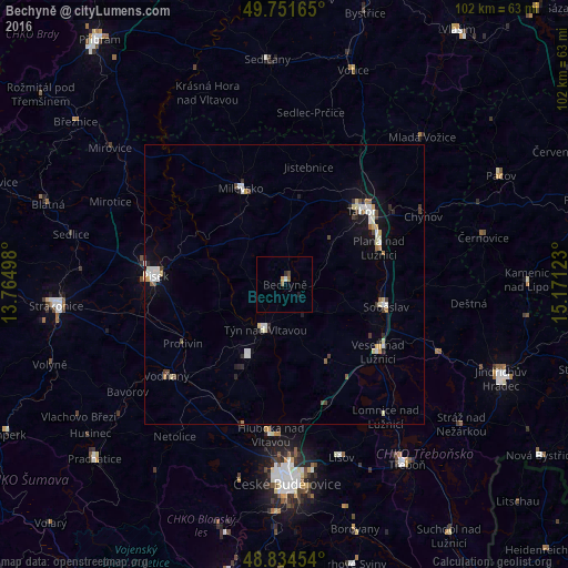
Analysis of Bechyně night lights 2016
Square area 10x10 km:
 0.27%
0.27%90-99
0.27%80-89
0%70-79
0.53%60-69
0.4%50-59
0.67%40-49
0.53%30-39
0.27%20-29
0.27%10-19
0.53%0-9
96.26%Square area 50x50 km:
0.46%90-99
0.52%80-89
0.31%70-79
0.23%60-69
0.17%50-59
0.16%40-49
0.38%30-39
0.21%20-29
0.45%10-19
1.33%0-9
95.81%Clear (daylight) street map image can be seen on geolist.org.
Map coordinates:
49° 45' 5.9" North, 13° 45' 53.9" East
49° 17' 42.8" North, 14° 28' 5.2" East
48° 50' 4.3" North, 15° 10' 16.4" East
Some cities around Bechyně sort by population:
• Tábor
19.1 km =11.9 mi,  46°
46°
• Písek
23.3 km =14.5 mi,  273°
273°
• Milevsko
19 km =11.8 mi,  335°
335°
• Týn nad Vltavou
8.7 km =5.4 mi,  203°
203°
• Sezimovo Ústí
18.6 km =11.6 mi,  57°
57°
• Soběslav
18.6 km =11.6 mi,  102°
102°
• Veselí nad Lužnicí
20.7 km =12.9 mi,  126°
126°
• Protivín
21.1 km =13.1 mi,  239°
239°
3079616 (p: 5,755)
Sources (retrieved 2019-11-25):
» Earth at Night: Flat Maps 2012, 2016