Praia night lights from space
Night Light of Praia from space (Cape Verde) Src. Average luminocity for 10x10km area is 45.8017% and for 50x50km: 2.5919%.
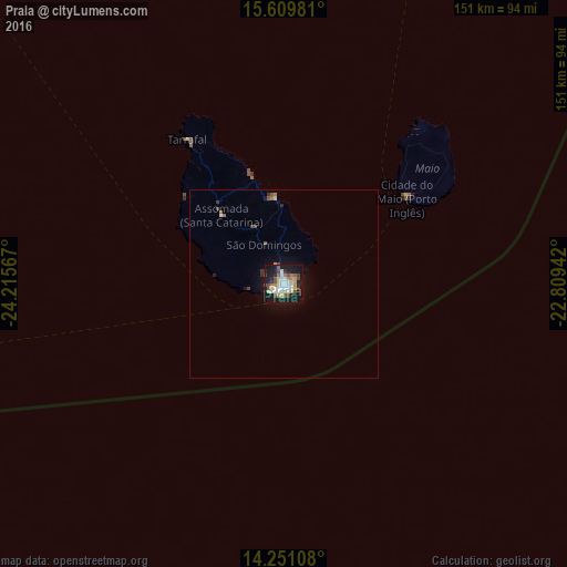
Analysis of Praia night lights 2016
Square area 10x10 km:
 8.06%
8.06%90-99
10.54%80-89
7.02%70-79
6.4%60-69
2.89%50-59
5.58%40-49
8.26%30-39
2.48%20-29
5.99%10-19
39.88%0-9
2.89%Square area 50x50 km:
0.32%90-99
0.45%80-89
0.31%70-79
0.27%60-69
0.23%50-59
0.34%40-49
0.5%30-39
0.22%20-29
0.35%10-19
2.65%0-9
94.35%Clear (daylight) street map image can be seen on geolist.org.
Map coordinates:
15° 36' 35.3" North, 24° 12' 56.4" West
14° 55' 53.5" North, 23° 30' 45.1" West
14° 15' 3.9" North, 22° 48' 33.9" West
Some cities around Praia sort by population:
• Santa Cruz
23.2 km =14.4 mi,  345°
345°
• Pedra Badejo
23 km =14.3 mi,  355°
355°
• Assomada
26.2 km =16.3 mi,  315°
315°
• Calheta
29.6 km =18.4 mi,  343°
343°
• Picos
21.2 km =13.2 mi, 322°
• Cidade Velha
10.1 km =6.3 mi,  259°
259°
• São Domingos
11.6 km =7.2 mi,  332°
332°
• João Teves
17.2 km =10.7 mi, 331°
3374333 (p: 113,364)
Sources (retrieved 2019-11-25):
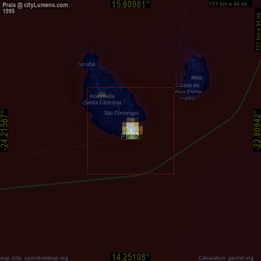
» NASA, Earths city lights 1995
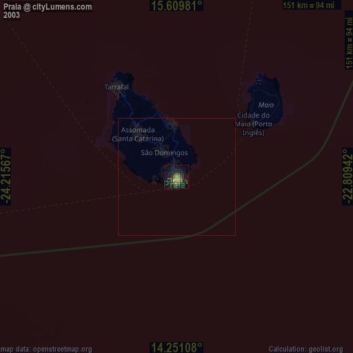
» NASA city lights 2003
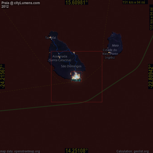
» Earth at Night: Flat Maps 2012, 2016