San Rafael night lights from space
Night Light of San Rafael (Heredia) from space (Costa Rica) Src. Average luminocity for 10x10km area is 78.5537% and for 50x50km: 30.8086%.
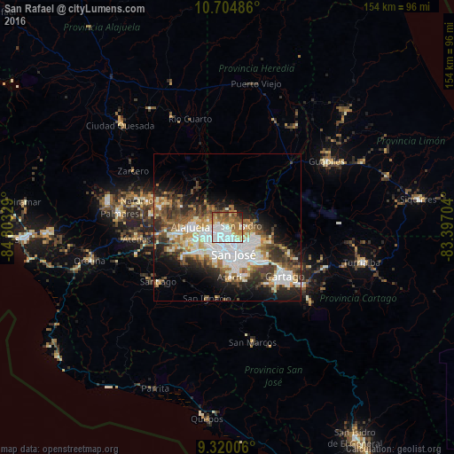
Analysis of San Rafael night lights 2016
Square area 10x10 km:
 26.86%
90-99
18.39%80-89
6.61%70-79
8.47%60-69
18.8%50-59
11.78%40-49
5.58%30-39
1.03%20-29
2.48%10-19
0%0-9
0%Square area 50x50 km:
7.85%90-99
6.37%80-89
2.98%70-79
2.79%60-69
4.49%50-59
4.23%40-49
4.49%30-39
4.54%20-29
6.32%10-19
8.91%0-9
47.02%Clear (daylight) street map image can be seen on geolist.org.
Map coordinates:
10° 42' 17.5" North, 84° 48' 11.8" West
10° 0' 47.5" North, 84° 6' 0.6" West
9° 19' 12.2" North, 83° 23' 49.3" West
Some cities around San Rafael sort by population:
• San Francisco
3.9 km =2.4 mi,  234°
234°
• San Juan
6.3 km =3.9 mi,  161°
161°
• Mercedes
3.8 km =2.4 mi,  259°
259°
• Heredia
2.2 km =1.4 mi,  236°
236°
• San Pablo
2 km =1.2 mi,  168°
168°
• Colima
7.1 km =4.4 mi, 166°
• San Josecito
0.4 km =0.2 mi,  2°
2°
• Llorente
6.2 km =3.9 mi,  254°
254°
3621683 (p: 8,887)
Sources (retrieved 2019-11-25):
» Earth at Night: Flat Maps 2012, 2016