Zhaotong night lights from space
Night Light of Zhaotong (Yunnan) from space (China) Src. Average luminocity for 10x10km area is 46.233% and for 50x50km: 3.3805%.
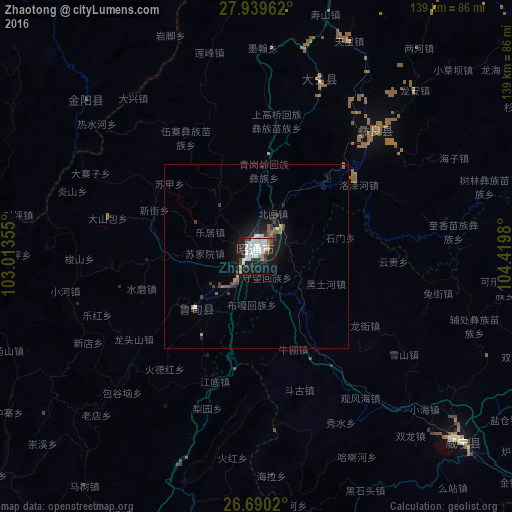

Analysis of Zhaotong night lights 2016
Square area 10x10 km:
 15.15%
90-99
12.31%80-89
1.33%70-79
2.27%60-69
5.49%50-59
2.08%40-49
2.65%30-39
7.95%20-29
8.9%10-19
33.33%0-9
8.52%Square area 50x50 km:
0.66%90-99
0.56%80-89
0.08%70-79
0.2%60-69
0.46%50-59
0.46%40-49
0.18%30-39
0.94%20-29
0.8%10-19
3.02%0-9
92.62%Clear (daylight) street map image can be seen on geolist.org.
Map coordinates:
27° 56' 22.6" North, 103° 0' 48.8" East
27° 19' 0" North, 103° 43' 0" East
26° 41' 24.7" North, 104° 25' 11.3" East
Some cities around Zhaotong sort by population:
• Dadukou
216.9 km =134.8 mi,  246°
246°
• Liupanshui
136.7 km =84.9 mi,  125°
125°
• Yibin
184.2 km =114.5 mi,  28°
28°
• Qujing
204 km =126.8 mi,  178°
178°
• Xichang
157 km =97.6 mi,  294°
294°
• Bijie
155.1 km =96.4 mi,  90°
90°
• Xunchang
160.1 km =99.5 mi,  37°
37°
• Weining
72.9 km =45.3 mi,  135°
135°
1784841 (p: 109,400)
Sources (retrieved 2019-11-25):
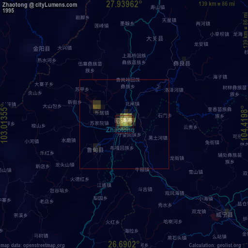
» NASA, Earths city lights 1995
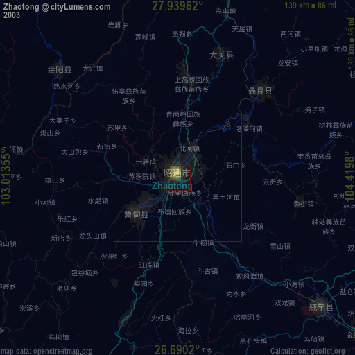
» NASA city lights 2003
» Earth at Night: Flat Maps 2012, 2016