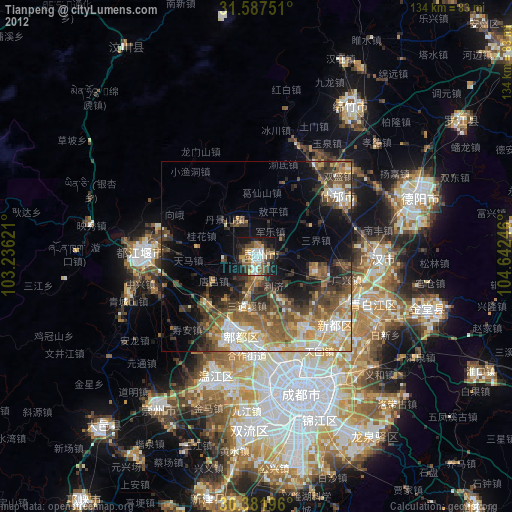
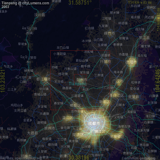
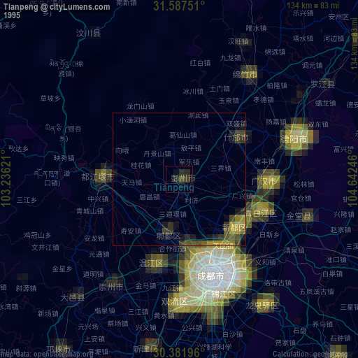
Tianpeng night lights from space
Night Light of Tianpeng (Sichuan) from space (China) Src. Average luminocity for 10x10km area is 41.0952% and for 50x50km: 21.1646%.
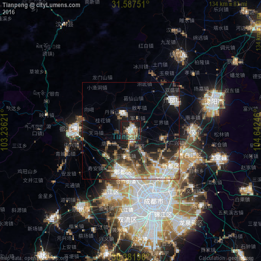
Analysis of Tianpeng night lights 2016
Square area 10x10 km:
 7.14%
7.14%90-99
6.78%80-89
4.03%70-79
1.1%60-69
9.52%50-59
8.97%40-49
4.58%30-39
2.38%20-29
14.29%10-19
39.93%0-9
1.28%Square area 50x50 km:
3.78%90-99
3.89%80-89
2.13%70-79
1.88%60-69
2.97%50-59
3.55%40-49
4.06%30-39
2.69%20-29
5.64%10-19
11.69%0-9
57.74%Clear (daylight) street map image can be seen on geolist.org.
Map coordinates:
31° 35' 15" North, 103° 14' 10.4" East
30° 59' 11.9" North, 103° 56' 21.6" East
30° 22' 55.1" North, 104° 38' 32.9" East
Some cities around Tianpeng sort by population:
• Chengdu
37.6 km =23.4 mi,  161°
161°
• Mianyang
88.6 km =55.1 mi,  52°
52°
• Leshan
159.3 km =99 mi,  186°
186°
• Deyang
45.1 km =28 mi,  69°
69°
• Jiangyou
113.9 km =70.8 mi,  40°
40°
• Yanjiang
117.8 km =73.2 mi,  144°
144°
• Tongchuan
110 km =68.4 mi,  83°
83°
• Linqiong
78.2 km =48.6 mi,  215°
215°
1792916 (p: 60,797)
Sources (retrieved 2019-11-25):
» NASA, Earths city lights 1995
» NASA city lights 2003
» Earth at Night: Flat Maps 2012, 2016