Deyang night lights from space
Night Light of Deyang (Sichuan) from space (China) Src. Average luminocity for 10x10km area is 80.5916% and for 50x50km: 12.995%.
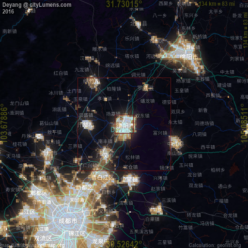
Analysis of Deyang night lights 2016
Square area 10x10 km:
 27.29%
90-99
27.84%80-89
7.14%70-79
5.68%60-69
11.72%50-59
7.51%40-49
4.4%30-39
3.11%20-29
4.21%10-19
1.1%0-9
0%Square area 50x50 km:
1.96%90-99
2.24%80-89
0.97%70-79
0.95%60-69
1.79%50-59
2.16%40-49
2.32%30-39
1.57%20-29
3.18%10-19
11.48%0-9
71.37%Clear (daylight) street map image can be seen on geolist.org.
Map coordinates:
31° 43' 48.5" North, 103° 40' 43.9" East
31° 7' 48.7" North, 104° 22' 55.1" East
30° 31' 35.1" North, 105° 5' 6.4" East
Some cities around Deyang sort by population:
• Chengdu
59.7 km =37.1 mi,  210°
210°
• Mianyang
47.1 km =29.3 mi,  37°
37°
• Jiangyou
77.6 km =48.2 mi,  24°
24°
• Suining
133.1 km =82.7 mi,  121°
121°
• Yanjiang
115.1 km =71.5 mi,  167°
167°
• Tianpeng
45.1 km =28 mi,  249°
249°
• Tongchuan
67.3 km =41.8 mi,  93°
93°
• Linqiong
118.5 km =73.6 mi,  227°
227°
1812961 (p: 152,194)
Sources (retrieved 2019-11-25):
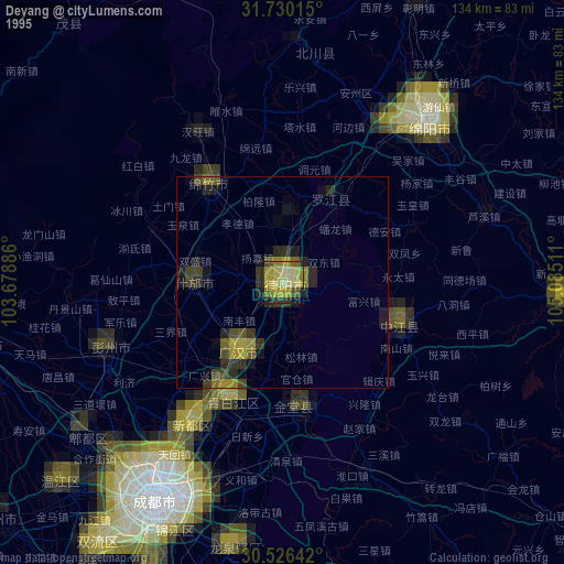
» NASA, Earths city lights 1995
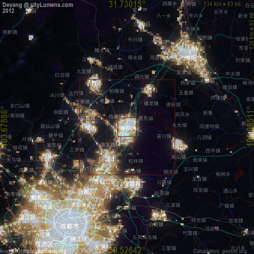
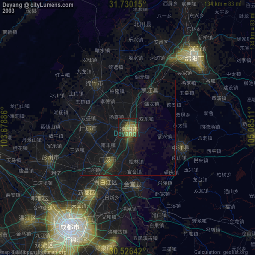
» NASA city lights 2003
» Earth at Night: Flat Maps 2012, 2016