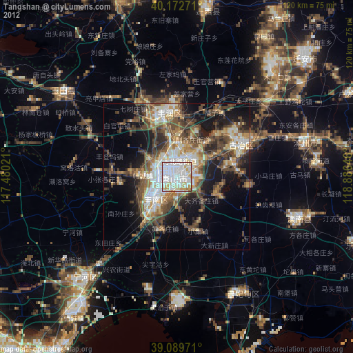
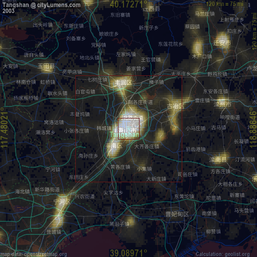
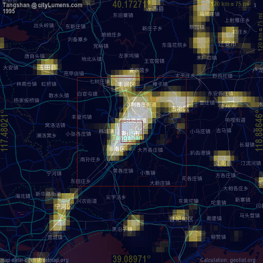
Tangshan night lights from space
Night Light of Tangshan (Hebei) from space (China) Src. Average luminocity for 10x10km area is 95.9481% and for 50x50km: 25.725%.
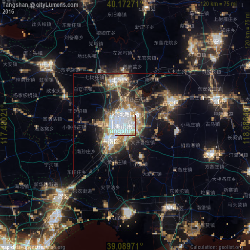
Analysis of Tangshan night lights 2016
Square area 10x10 km:
 64.29%
90-99
21.43%80-89
4.22%70-79
7.63%60-69
2.11%50-59
0.32%40-49
0%30-39
0%20-29
0%10-19
0%0-9
0%Square area 50x50 km:
5.15%90-99
3.48%80-89
2.52%70-79
2.83%60-69
3.74%50-59
5.05%40-49
3.91%30-39
5.24%20-29
6.7%10-19
11.8%0-9
49.59%Clear (daylight) street map image can be seen on geolist.org.
Map coordinates:
40° 10' 21.8" North, 117° 28' 48.8" East
39° 37' 60" North, 118° 10' 60" East
39° 5' 23" North, 118° 53' 11.3" East
Some cities around Tangshan sort by population:
• Hangu
54.5 km =33.9 mi,  218°
218°
• Linxi
24.4 km =15.2 mi,  69°
69°
• Zhaogezhuang
24.5 km =15.2 mi,  53°
53°
• Tangjiazhuang
26 km =16.2 mi,  61°
61°
• Fengrun
23 km =14.3 mi,  345°
345°
• Guye
24.5 km =15.2 mi, 63°
• Biaokou
64 km =39.8 mi,  237°
237°
• Fengtai
38.1 km =23.7 mi,  257°
257°
1793346 (p: 3,372,102)
Sources (retrieved 2019-11-25):
» NASA, Earths city lights 1995
» NASA city lights 2003
» Earth at Night: Flat Maps 2012, 2016