Qufu night lights from space
Night Light of Qufu (Shandong) from space (China) Src. Average luminocity for 10x10km area is 31.8059% and for 50x50km: 12.822%.
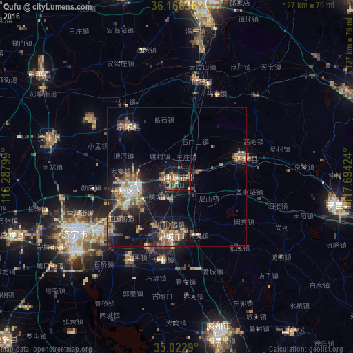

Analysis of Qufu night lights 2016
Square area 10x10 km:
 0%
0%90-99
0.52%80-89
3.5%70-79
6.47%60-69
6.82%50-59
12.41%40-49
6.99%30-39
6.64%20-29
6.47%10-19
30.42%0-9
19.76%Square area 50x50 km:
0.76%90-99
1.27%80-89
1.73%70-79
1.55%60-69
2.19%50-59
3.14%40-49
1.84%30-39
2.84%20-29
3.68%10-19
9.72%0-9
71.27%Clear (daylight) street map image can be seen on geolist.org.
Map coordinates:
36° 9' 58.9" North, 116° 17' 16.8" East
35° 35' 48" North, 116° 59' 28" East
35° 1' 22.4" North, 117° 41' 39.3" East
Some cities around Qufu sort by population:
• Jining
42.8 km =26.6 mi,  240°
240°
• Zoucheng
21.9 km =13.6 mi,  186°
186°
• Chengtangcun
59.9 km =37.2 mi,  162°
162°
• Sishui
26.4 km =16.4 mi,  77°
77°
• Ningyang
25.9 km =16.1 mi,  315°
315°
• Pingyi
58.9 km =36.6 mi,  100°
100°
• Yanzhou
15.5 km =9.6 mi,  251°
251°
• Wenshang
47 km =29.2 mi,  288°
288°
1797333 (p: 85,144)
Sources (retrieved 2019-11-25):
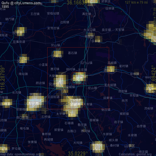
» NASA, Earths city lights 1995
» NASA city lights 2003
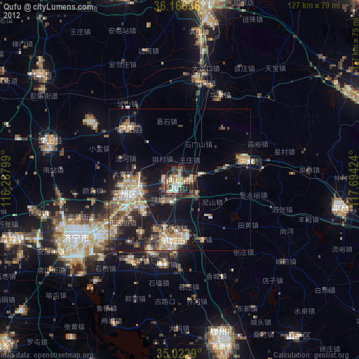
» Earth at Night: Flat Maps 2012, 2016