Jining night lights from space
Night Light of Jining (Shandong) from space (China) Src. Average luminocity for 10x10km area is 87.7179% and for 50x50km: 21.5045%.
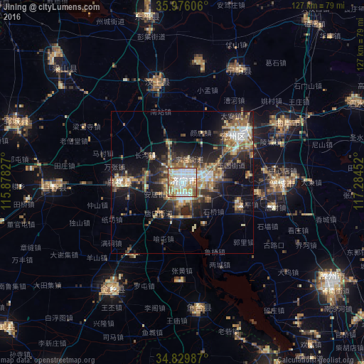
Analysis of Jining night lights 2016
Square area 10x10 km:
 30.4%
30.4%90-99
29.12%80-89
11.9%70-79
13.37%60-69
8.97%50-59
5.31%40-49
0.92%30-39
0%20-29
0%10-19
0%0-9
0%Square area 50x50 km:
2.46%90-99
3.56%80-89
2.82%70-79
2.96%60-69
3.2%50-59
3.67%40-49
2.69%30-39
4.12%20-29
6.22%10-19
12.37%0-9
55.93%Clear (daylight) street map image can be seen on geolist.org.
Map coordinates:
35° 58' 33.8" North, 115° 52' 41.8" East
35° 24' 18" North, 116° 34' 53" East
34° 49' 47.5" North, 117° 17' 4.3" East
Some cities around Jining sort by population:
• Zoucheng
34.8 km =21.6 mi,  90°
90°
• Qufu
42.8 km =26.6 mi,  60°
60°
• Ningyang
44.2 km =27.5 mi,  25°
25°
• Yanzhou
27.8 km =17.3 mi,  53°
53°
• Zhoucheng
61.4 km =38.2 mi,  336°
336°
• Yucheng
54 km =33.6 mi,  191°
191°
• Wenshang
36.7 km =22.8 mi,  347°
347°
• Juye
44.7 km =27.8 mi,  268°
268°
1805518 (p: 450,327)
Sources (retrieved 2019-11-25):
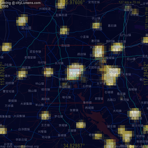
» NASA, Earths city lights 1995
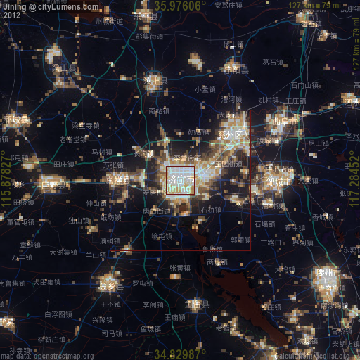
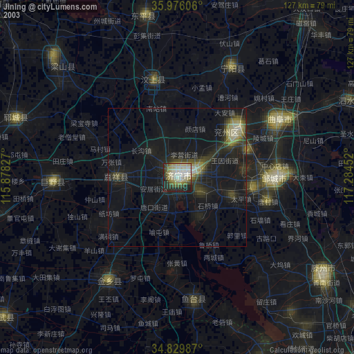
» NASA city lights 2003
» Earth at Night: Flat Maps 2012, 2016