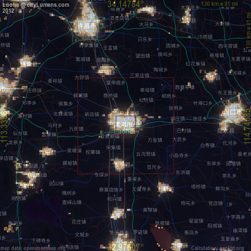
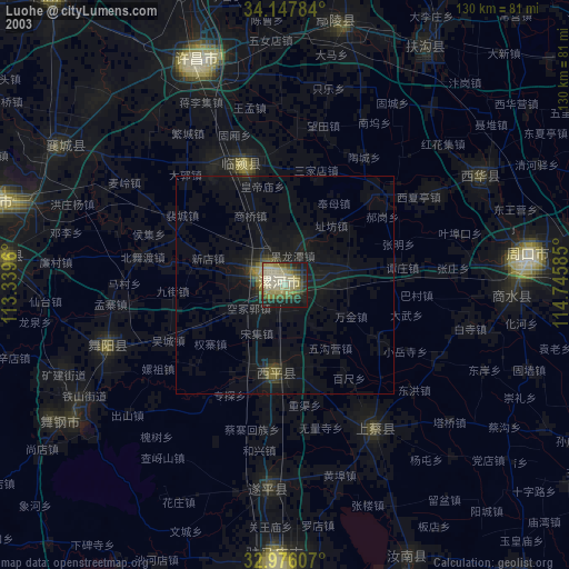
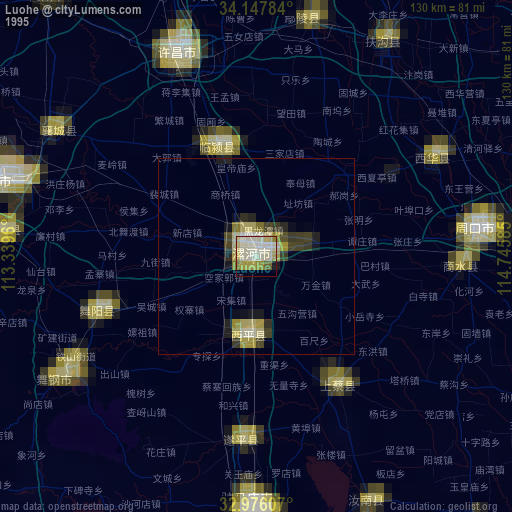
Luohe night lights from space
Night Light of Luohe (Henan) from space (China) Src. Average luminocity for 10x10km area is 79.9194% and for 50x50km: 8.9337%.
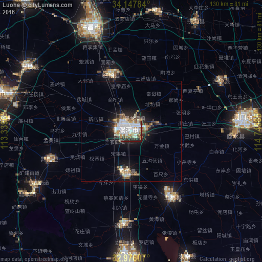
Analysis of Luohe night lights 2016
Square area 10x10 km:
 28.94%
90-99
28.75%80-89
6.59%70-79
6.96%60-69
4.21%50-59
6.41%40-49
4.76%30-39
4.95%20-29
8.06%10-19
0.37%0-9
0%Square area 50x50 km:
1.64%90-99
1.99%80-89
0.82%70-79
0.89%60-69
0.83%50-59
1.04%40-49
1.01%30-39
1.5%20-29
2.18%10-19
5.8%0-9
82.31%Clear (daylight) street map image can be seen on geolist.org.
Map coordinates:
34° 8' 52.2" North, 113° 20' 22.6" East
33° 33' 50.2" North, 114° 2' 33.8" East
32° 58' 33.9" North, 114° 44' 45.1" East
Some cities around Luohe sort by population:
• Xuchang
54.6 km =33.9 mi,  342°
342°
• Pingdingshan
71.3 km =44.3 mi,  285°
285°
• Zhumadian
65 km =40.4 mi,  181°
181°
• Zhoukou
55.2 km =34.3 mi,  81°
81°
• Yingchuan
85.4 km =53.1 mi,  321°
321°
• Wacheng
50.2 km =31.2 mi,  60°
60°
• Xiangcheng Chengguanzhen
61 km =37.9 mi,  301°
301°
• Runing
69 km =42.9 mi,  155°
155°
1801934 (p: 417,356)
Sources (retrieved 2019-11-25):
» NASA, Earths city lights 1995
» NASA city lights 2003
» Earth at Night: Flat Maps 2012, 2016