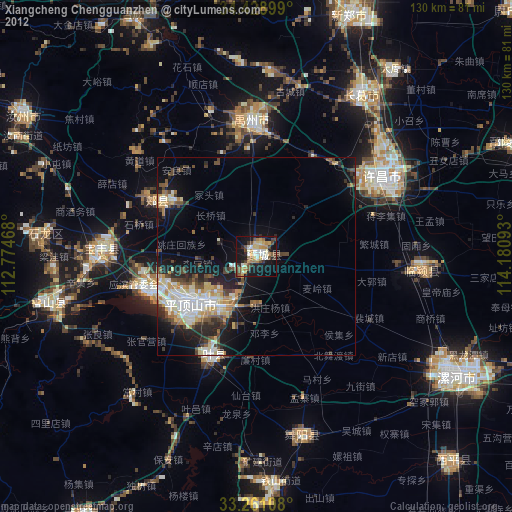
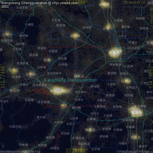
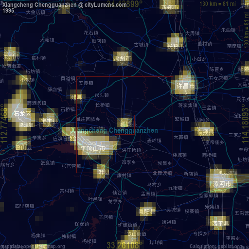
Xiangcheng Chengguanzhen night lights from space
Night Light of Xiangcheng Chengguanzhen (Henan) from space (China) Src. Average luminocity for 10x10km area is 36.4878% and for 50x50km: 11.4484%.
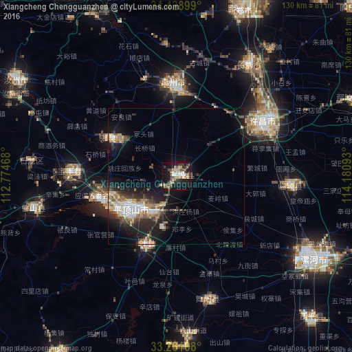
Analysis of Xiangcheng Chengguanzhen night lights 2016
Square area 10x10 km:
 3.15%
3.15%90-99
6.64%80-89
5.07%70-79
4.9%60-69
5.94%50-59
5.59%40-49
3.85%30-39
8.39%20-29
5.42%10-19
40.56%0-9
10.49%Square area 50x50 km:
1.27%90-99
1.93%80-89
1.38%70-79
1.35%60-69
1.54%50-59
1.62%40-49
1.58%30-39
2.1%20-29
3.58%10-19
9%0-9
74.65%Clear (daylight) street map image can be seen on geolist.org.
Map coordinates:
34° 25' 44.4" North, 112° 46' 28.8" East
33° 50' 49.3" North, 113° 28' 40.1" East
33° 15' 39.9" North, 114° 10' 51.3" East
Some cities around Xiangcheng Chengguanzhen sort by population:
• Zhengzhou
102.5 km =63.7 mi,  8°
8°
• Xuchang
41 km =25.5 mi,  59°
59°
• Pingdingshan
20.3 km =12.6 mi,  233°
233°
• Luohe
61 km =37.9 mi,  121°
121°
• Yingchuan
35.1 km =21.8 mi,  357°
357°
• Yunyang
83.5 km =51.9 mi,  237°
237°
• Wacheng
96.2 km =59.8 mi,  94°
94°
• Songyang
79.3 km =49.3 mi,  328°
328°
1790601 (p: 65,833)
Sources (retrieved 2019-11-25):
» NASA, Earths city lights 1995
» NASA city lights 2003
» Earth at Night: Flat Maps 2012, 2016