Kaifeng night lights from space
Night Light of Kaifeng (Henan) from space (China) Src. Average luminocity for 10x10km area is 87.0989% and for 50x50km: 12.4957%.
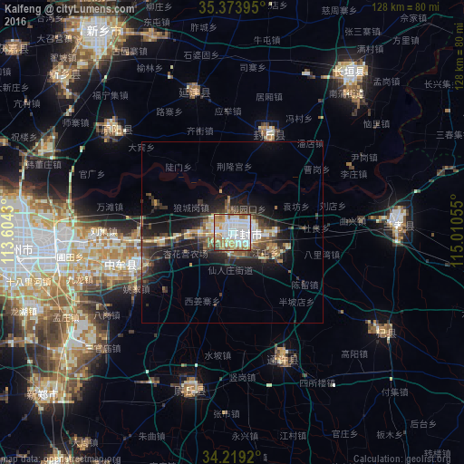
Analysis of Kaifeng night lights 2016
Square area 10x10 km:
 29.3%
29.3%90-99
31.87%80-89
7.51%70-79
11.72%60-69
11.36%50-59
5.31%40-49
2.93%30-39
0%20-29
0%10-19
0%0-9
0%Square area 50x50 km:
1.54%90-99
2.28%80-89
1.37%70-79
1.3%60-69
1.57%50-59
1.87%40-49
2%30-39
3.18%20-29
3.38%10-19
8.21%0-9
73.29%Clear (daylight) street map image can be seen on geolist.org.
Map coordinates:
35° 22' 26.2" North, 113° 36' 15.5" East
34° 47' 55" North, 114° 18' 26.7" East
34° 13' 9.1" North, 115° 0' 38" East
Some cities around Kaifeng sort by population:
• Zhengzhou
60.3 km =37.5 mi,  265°
265°
• Xuchang
94.5 km =58.7 mi,  205°
205°
• Xinxiang
63.4 km =39.4 mi,  313°
313°
• Jiaozuo
109.4 km =68 mi,  296°
296°
• Yingchuan
104.8 km =65.1 mi,  227°
227°
• Wacheng
114.5 km =71.1 mi,  170°
170°
• Yigou
112.6 km =70 mi,  0°
0°
• Daokou
87 km =54.1 mi,  11°
11°
1804879 (p: 900,000)
Sources (retrieved 2019-11-25):
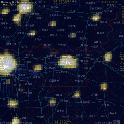
» NASA, Earths city lights 1995
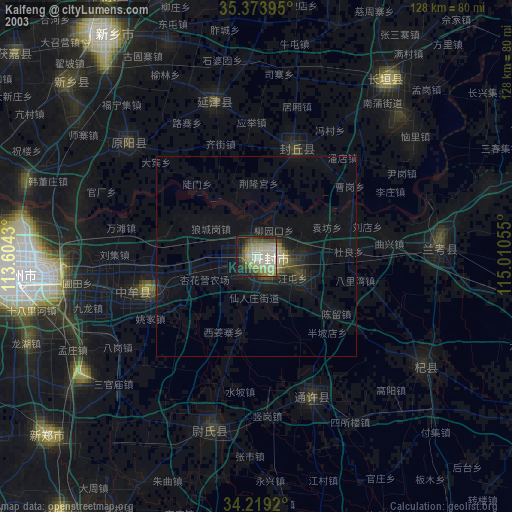
» NASA city lights 2003
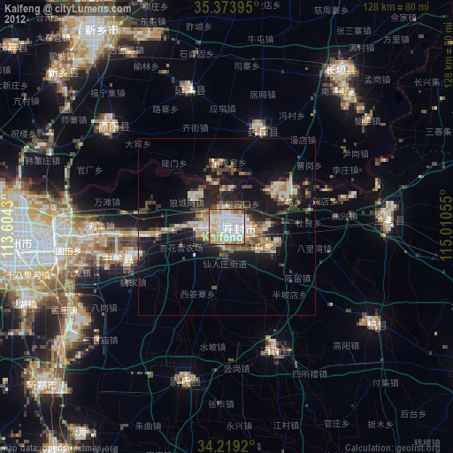
» Earth at Night: Flat Maps 2012, 2016