Yigou night lights from space
Night Light of Yigou (Henan) from space (China) Src. Average luminocity for 10x10km area is 17.6993% and for 50x50km: 12.4088%.
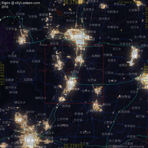
Analysis of Yigou night lights 2016
Square area 10x10 km:
 1.4%
1.4%90-99
2.97%80-89
0.7%70-79
1.92%60-69
2.1%50-59
0%40-49
3.5%30-39
6.47%20-29
6.12%10-19
20.1%0-9
54.72%Square area 50x50 km:
0.82%90-99
1.91%80-89
1.27%70-79
1.19%60-69
1.74%50-59
1.98%40-49
2.02%30-39
3.36%20-29
3.53%10-19
11.4%0-9
70.78%Clear (daylight) street map image can be seen on geolist.org.
Map coordinates:
36° 22' 46.3" North, 113° 36' 48.8" East
35° 48' 41" North, 114° 19' 0" East
35° 14' 20.9" North, 115° 1' 11.3" East
Some cities around Yigou sort by population:
• Anyang
32.2 km =20 mi,  10°
10°
• Xinxiang
83.3 km =51.8 mi,  214°
214°
• Puyang Chengguanzhen
64 km =39.8 mi,  100°
100°
• Hebi
14.8 km =9.2 mi,  311°
311°
• Linshui
68.9 km =42.8 mi,  351°
351°
• Hecun
82.4 km =51.2 mi, 347°
• Pengcheng
70.2 km =43.6 mi, 349°
• Daokou
32.4 km =20.1 mi,  148°
148°
1786720 (p: 59,073)
Sources (retrieved 2019-11-25):
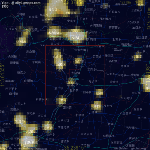
» NASA, Earths city lights 1995
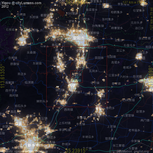
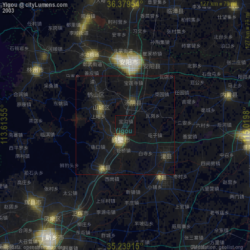
» NASA city lights 2003
» Earth at Night: Flat Maps 2012, 2016