Huazhou night lights from space
Night Light of Huazhou (Guangdong) from space (China) Src. Average luminocity for 10x10km area is 20.6136% and for 50x50km: 10.4709%.
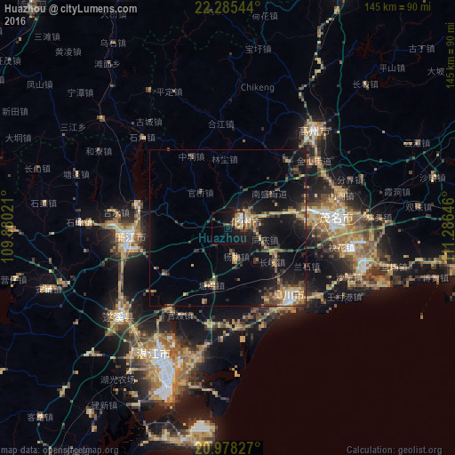
Analysis of Huazhou night lights 2016
Square area 10x10 km:
 1.14%
1.14%90-99
3.6%80-89
4.55%70-79
1.14%60-69
3.03%50-59
4.36%40-49
3.03%30-39
2.27%20-29
0.76%10-19
22.16%0-9
53.98%Square area 50x50 km:
0.45%90-99
0.6%80-89
1.66%70-79
1.4%60-69
1.43%50-59
1.64%40-49
2%30-39
2.95%20-29
2.41%10-19
10.3%0-9
75.18%Clear (daylight) street map image can be seen on geolist.org.
Map coordinates:
22° 17' 7.6" North, 109° 52' 48.8" East
21° 37' 60" North, 110° 34' 60" East
20° 58' 41.8" North, 111° 17' 11.3" East
Some cities around Huazhou sort by population:
• Zhongshan
34.9 km =21.7 mi,  181°
181°
• Zhanjiang
46.4 km =28.8 mi,  212°
212°
• Gaozhou
43.5 km =27 mi,  38°
38°
• Yulin
119.8 km =74.4 mi,  338°
338°
• Wuchuan
27.2 km =16.9 mi,  136°
136°
• Lianjiang
31.2 km =19.4 mi,  272°
272°
• Xinyi
90.4 km =56.2 mi,  24°
24°
• Yashan
91.2 km =56.7 mi,  313°
313°
1806960 (p: 91,701)
Sources (retrieved 2019-11-25):
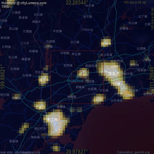
» NASA, Earths city lights 1995
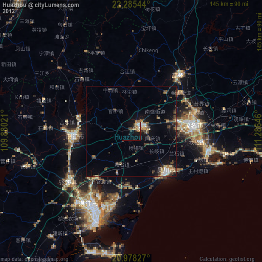
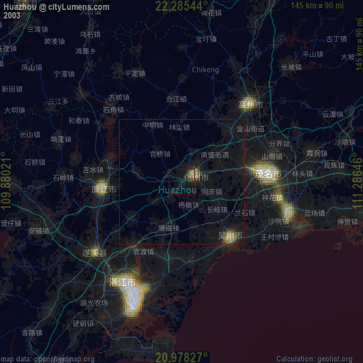
» NASA city lights 2003
» Earth at Night: Flat Maps 2012, 2016