Hegang night lights from space
Night Light of Hegang (Heilongjiang) from space (China) Src. Average luminocity for 10x10km area is 23.5074% and for 50x50km: 2.09%.
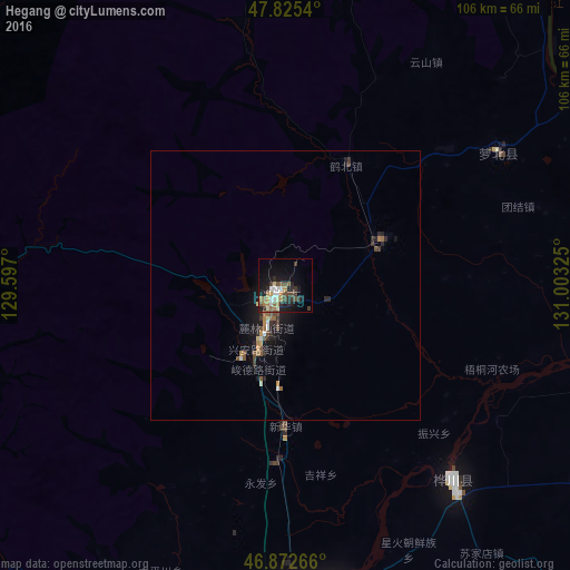
Analysis of Hegang night lights 2016
Square area 10x10 km:
 2.98%
2.98%90-99
3.72%80-89
1.49%70-79
2.08%60-69
4.76%50-59
2.68%40-49
4.61%30-39
5.21%20-29
5.36%10-19
17.71%0-9
49.4%Square area 50x50 km:
0.15%90-99
0.26%80-89
0.12%70-79
0.17%60-69
0.41%50-59
0.32%40-49
0.41%30-39
0.44%20-29
0.52%10-19
1.94%0-9
95.26%Clear (daylight) street map image can be seen on geolist.org.
Map coordinates:
47° 49' 31.4" North, 129° 35' 49.2" East
47° 21' 4.2" North, 130° 18' 0.4" East
46° 52' 21.6" North, 131° 0' 11.7" East
Some cities around Hegang sort by population:
• Shuangyashan
102.5 km =63.7 mi,  140°
140°
• Jiamusi
61.4 km =38.2 mi,  178°
178°
• Yichun
114.6 km =71.2 mi,  291°
291°
• Lianhe
81.1 km =50.4 mi,  252°
252°
• Lingdong
108.2 km =67.2 mi, 143°
• Fuli
94.6 km =58.8 mi, 137°
• Fengxiang
46.6 km =29 mi,  57°
57°
• Amurzet, RU
70.9 km =44.1 mi, 57°
2036986 (p: 743,307)
Sources (retrieved 2019-11-25):
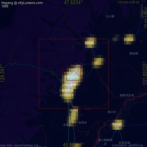
» NASA, Earths city lights 1995
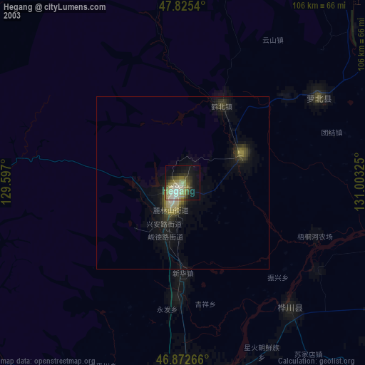
» NASA city lights 2003
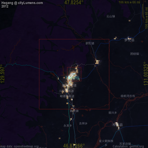
» Earth at Night: Flat Maps 2012, 2016