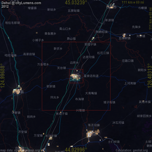
Dehui night lights from space
Night Light of Dehui (Jilin) from space (China) Src. Average luminocity for 10x10km area is 25.6381% and for 50x50km: 1.0695%.


Analysis of Dehui night lights 2016
Square area 10x10 km:
 1.9%
1.9%90-99
6.83%80-89
3.02%70-79
2.86%60-69
2.06%50-59
6.35%40-49
1.59%30-39
0.79%20-29
3.97%10-19
26.19%0-9
44.44%Square area 50x50 km:
0.07%90-99
0.26%80-89
0.11%70-79
0.11%60-69
0.08%50-59
0.24%40-49
0.06%30-39
0.05%20-29
0.15%10-19
1.02%0-9
97.84%Clear (daylight) street map image can be seen on geolist.org.
Map coordinates:
45° 1' 56.6" North, 124° 59' 48.8" East
44° 31' 60" North, 125° 42' 0" East
44° 1' 47.9" North, 126° 24' 11.3" East
Some cities around Dehui sort by population:
• Changchun
78.6 km =48.8 mi,  202°
202°
• Jiutai
43.6 km =27.1 mi,  165°
165°
• Fuyu
100.4 km =62.4 mi,  316°
316°
• Yushu
72.3 km =44.9 mi,  65°
65°
• Songyuan
95.5 km =59.3 mi,  313°
313°
• Jishu
90.6 km =56.3 mi,  105°
105°
• Shulan
100 km =62.1 mi,  97°
97°
• Xinglongshan
66.8 km =41.5 mi, 196°
2037712 (p: 108,818)
Sources (retrieved 2019-11-25):
» NASA, Earths city lights 1995
» NASA city lights 2003
» Earth at Night: Flat Maps 2012, 2016