Zhu Cheng City night lights from space
Night Light of Zhu Cheng City (Shandong) from space (China) Src. Average luminocity for 10x10km area is 56.7051% and for 50x50km: 5.5444%.
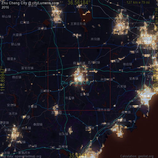
Analysis of Zhu Cheng City night lights 2016
Square area 10x10 km:
 6.78%
6.78%90-99
10.44%80-89
9.89%70-79
6.59%60-69
13.92%50-59
10.62%40-49
6.23%30-39
11.17%20-29
14.84%10-19
9.52%0-9
0%Square area 50x50 km:
0.27%90-99
0.43%80-89
0.66%70-79
0.59%60-69
1.08%50-59
1.19%40-49
1.05%30-39
1.67%20-29
1.86%10-19
3.38%0-9
87.83%Clear (daylight) street map image can be seen on geolist.org.
Map coordinates:
36° 33' 42.6" North, 118° 41' 58.1" East
35° 59' 42.1" North, 119° 24' 9.3" East
35° 25' 26.8" North, 120° 6' 20.6" East
Some cities around Zhu Cheng City sort by population:
• Rizhao
63.3 km =39.3 mi,  175°
175°
• Jiaozhou
62.8 km =39 mi,  59°
59°
• Gaomi
53.4 km =33.2 mi,  36°
36°
• Mizhou
0.5 km =0.3 mi,  265°
265°
• Anqiu
52.3 km =32.5 mi,  338°
338°
• Yishui
73.6 km =45.7 mi,  251°
251°
• Yinzhu
53.2 km =33.1 mi,  104°
104°
• Chengyang
69.1 km =42.9 mi,  228°
228°
7602670 (p: 1,000,000)
Sources (retrieved 2019-11-25):
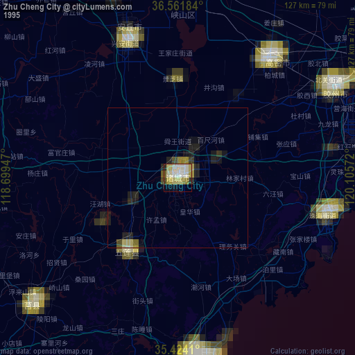
» NASA, Earths city lights 1995
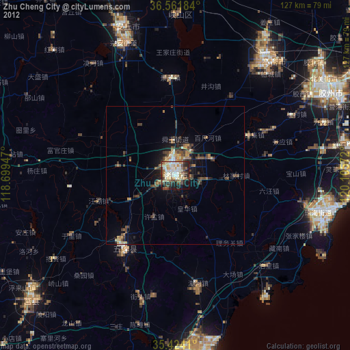
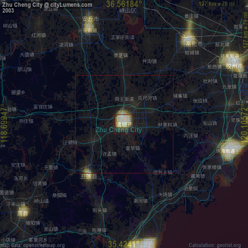
» NASA city lights 2003
» Earth at Night: Flat Maps 2012, 2016