Tiko night lights from space
Night Light of Tiko (South-West) from space (Cameroon) Src. Average luminocity for 10x10km area is 3.5519% and for 50x50km: 3.2989%.
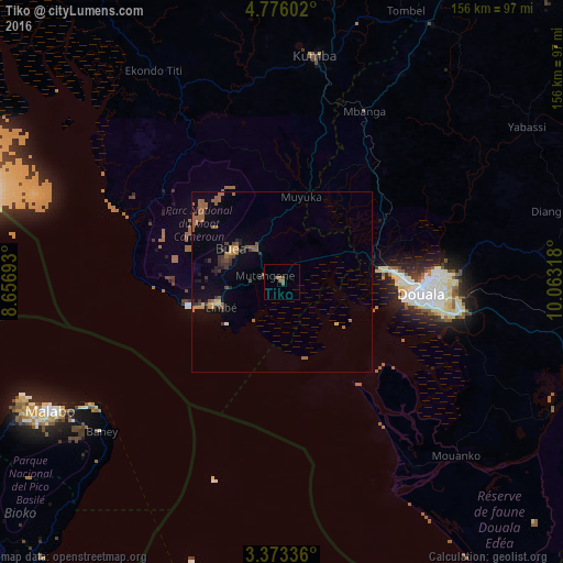
Analysis of Tiko night lights 2016
Square area 10x10 km:
 0%
0%90-99
0%80-89
0%70-79
0%60-69
0.43%50-59
4.11%40-49
1.08%30-39
0%20-29
0.43%10-19
0%0-9
93.94%Square area 50x50 km:
0%90-99
0.09%80-89
0.21%70-79
0.31%60-69
1.01%50-59
1.29%40-49
0.43%30-39
0.65%20-29
0.53%10-19
1.01%0-9
94.46%Clear (daylight) street map image can be seen on geolist.org.
Map coordinates:
4° 46' 33.7" North, 8° 39' 24.9" East
4° 4' 30" North, 9° 21' 36.2" East
3° 22' 24.1" North, 10° 3' 47.4" East
Some cities around Tiko sort by population:
• Douala
38.3 km =23.8 mi,  94°
94°
• Limbe
18 km =11.2 mi,  251°
251°
• Mutengene
5.4 km =3.4 mi,  289°
289°
• Buea
15.7 km =9.8 mi,  303°
303°
• Mbanga
52.7 km =32.7 mi,  25°
25°
• Muyuka
24.5 km =15.2 mi,  13°
13°
• Bonabéri
35.7 km =22.2 mi, 90°
• Ndom
52.1 km =32.4 mi, 25°
2221504 (p: 55,914)
Sources (retrieved 2019-11-25):
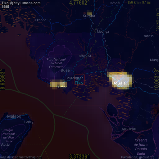
» NASA, Earths city lights 1995
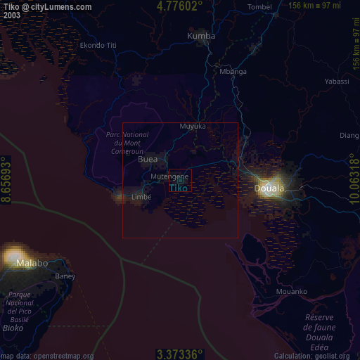
» NASA city lights 2003
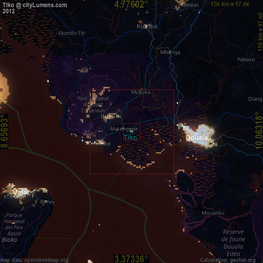
» Earth at Night: Flat Maps 2012, 2016