Buea night lights from space
Night Light of Buea (South-West) from space (Cameroon) Src. Average luminocity for 10x10km area is 18.1039% and for 50x50km: 4.4038%.
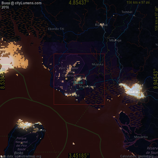
Analysis of Buea night lights 2016
Square area 10x10 km:
100  0%
0%
90-99 0%
80-89 0.87%
70-79 2.38%
60-69 5.19%
50-59 3.68%
40-49 4.98%
30-39 8.01%
20-29 5.63%
10-19 4.11%
0-9 65.15%
0%90-99
0%80-89
0.87%70-79
2.38%60-69
5.19%50-59
3.68%40-49
4.98%30-39
8.01%20-29
5.63%10-19
4.11%0-9
65.15%Square area 50x50 km:
100 0.07%
90-99 0.16%
80-89 0.19%
70-79 0.31%
60-69 1.59%
50-59 1.48%
40-49 0.69%
30-39 0.82%
20-29 0.63%
10-19 1.27%
0-9 92.8%
0.07%90-99
0.16%80-89
0.19%70-79
0.31%60-69
1.59%50-59
1.48%40-49
0.69%30-39
0.82%20-29
0.63%10-19
1.27%0-9
92.8%Clear (daylight) street map image can be seen on geolist.org.
Map coordinates:
4° 51' 15.7" North, 8° 32' 21" East
4° 9' 12.3" North, 9° 14' 32.3" East
3° 27' 6.7" North, 9° 56' 43.5" East
Some cities around Buea sort by population:
• Douala
52.6 km =32.7 mi,  102°
102°
• Limbe
15 km =9.3 mi,  195°
195°
• Tiko
15.7 km =9.8 mi,  123°
123°
• Mutengene
10.6 km =6.6 mi,  130°
130°
• Muyuka
24 km =14.9 mi,  50°
50°
• Bamusso
50.7 km =31.5 mi,  312°
312°
• Bonabéri
49.6 km =30.8 mi, 100°
• Ndom
52.2 km =32.4 mi,  42°
42°
2233410 (p: 47,300)
Sources (retrieved 2019-11-25):
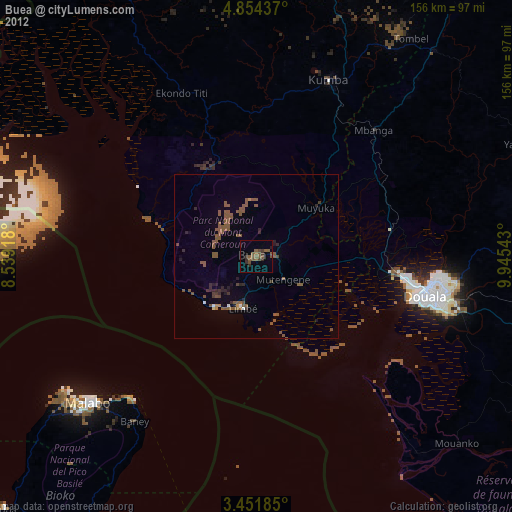
» Earth at Night: Flat Maps 2012, 2016