Seen (Kreis 3) night lights from space
Night Light of Seen (Kreis 3) (Zurich) from space (Switzerland) Src. Average luminocity for 10x10km area is 19.6676% and for 50x50km: 12.9219%.
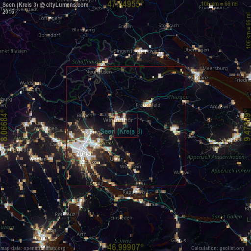
Analysis of Seen (Kreis 3) night lights 2016
Square area 10x10 km:
 2.56%
2.56%90-99
5.11%80-89
2.56%70-79
2.56%60-69
2.13%50-59
1.56%40-49
1.56%30-39
0.71%20-29
1.56%10-19
18.61%0-9
61.08%Square area 50x50 km:
2.38%90-99
2.28%80-89
1.17%70-79
1.11%60-69
1.57%50-59
1.4%40-49
1.94%30-39
2.18%20-29
3.33%10-19
7.3%0-9
75.34%Clear (daylight) street map image can be seen on geolist.org.
Map coordinates:
47° 56' 58.4" North, 8° 4' 0.6" East
47° 28' 35.3" North, 8° 46' 11.9" East
46° 59' 56.7" North, 9° 28' 23.1" East
Some cities around Seen (Kreis 3) sort by population:
• Winterthur
4.7 km =2.9 mi,  313°
313°
• Oberwinterthur (Kreis 2)
4.5 km =2.8 mi,  358°
358°
• Stadt Winterthur (Kreis 1)
4.3 km =2.7 mi,  298°
298°
• Mattenbach (Kreis 7)
2.1 km =1.3 mi, 304°
• Töss (Kreis 4)
5.1 km =3.2 mi,  273°
273°
• Mattenbach (Kreis 7) / Deutweg
3 km =1.9 mi, 310°
• Oberwinterthur (Kreis 2) / Guggenbühl
4.2 km =2.6 mi,  349°
349°
• Oberwinterthur (Kreis 2) / Talacker
3.6 km =2.2 mi,  337°
337°
6295531 (p: 15,434)
Sources (retrieved 2019-11-25):
» Earth at Night: Flat Maps 2012, 2016