Oberwinterthur (Kreis 2) night lights from space
Night Light of Oberwinterthur (Kreis 2) (Zurich) from space (Switzerland) Src. Average luminocity for 10x10km area is 20.3778% and for 50x50km: 12.8065%.
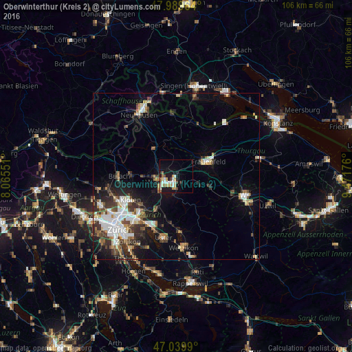
Analysis of Oberwinterthur (Kreis 2) night lights 2016
Square area 10x10 km:
 2.56%
2.56%90-99
5.11%80-89
2.56%70-79
2.56%60-69
2.7%50-59
1.56%40-49
1.56%30-39
0.71%20-29
2.13%10-19
20.31%0-9
58.24%Square area 50x50 km:
2.42%90-99
2.37%80-89
1.24%70-79
1.11%60-69
1.42%50-59
1.27%40-49
1.87%30-39
2.11%20-29
3.25%10-19
6.96%0-9
75.98%Clear (daylight) street map image can be seen on geolist.org.
Map coordinates:
47° 59' 22.7" North, 8° 3' 55.8" East
47° 31' 0.9" North, 8° 46' 7.1" East
47° 2' 23.6" North, 9° 28' 18.3" East
Some cities around Oberwinterthur (Kreis 2) sort by population:
• Winterthur
3.6 km =2.2 mi,  249°
249°
• Stadt Winterthur (Kreis 1)
4.4 km =2.7 mi,  236°
236°
• Seen (Kreis 3)
4.5 km =2.8 mi,  178°
178°
• Wülflingen (Kreis 6)
6.4 km =4 mi,  263°
263°
• Mattenbach (Kreis 7)
3.7 km =2.3 mi,  206°
206°
• Veltheim (Kreis 5)
3.9 km =2.4 mi,  265°
265°
• Töss (Kreis 4)
6.5 km =4 mi,  229°
229°
• Mattenbach (Kreis 7) / Deutweg
3.3 km =2.1 mi,  220°
220°
6295536 (p: 16,356)
Sources (retrieved 2019-11-25):
» Earth at Night: Flat Maps 2012, 2016