Winterthur night lights from space
Night Light of Winterthur (Zurich) from space (Switzerland) Src. Average luminocity for 10x10km area is 26.2884% and for 50x50km: 13.1869%.

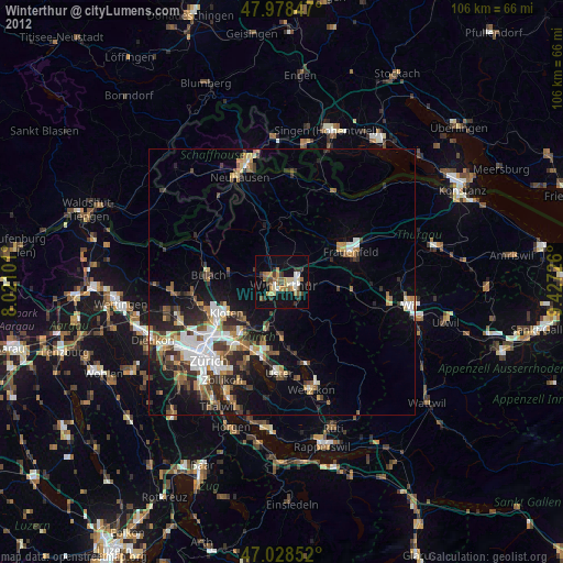
Analysis of Winterthur night lights 2016
Square area 10x10 km:
 2.56%
2.56%90-99
5.11%80-89
2.98%70-79
4.4%60-69
3.27%50-59
2.7%40-49
2.56%30-39
1.28%20-29
4.12%10-19
33.95%0-9
37.07%Square area 50x50 km:
2.48%90-99
2.38%80-89
1.09%70-79
1.16%60-69
1.47%50-59
1.43%40-49
2.06%30-39
2.2%20-29
3.58%10-19
7.88%0-9
74.27%Clear (daylight) street map image can be seen on geolist.org.
Map coordinates:
47° 58' 42.5" North, 8° 1' 15.6" East
47° 30' 20.3" North, 8° 43' 26.9" East
47° 1' 42.7" North, 9° 25' 38.1" East
Some cities around Winterthur sort by population:
• Stadt Winterthur (Kreis 1)
1.2 km =0.7 mi,  196°
196°
• Wülflingen (Kreis 6)
3.1 km =1.9 mi,  279°
279°
• Mattenbach (Kreis 7)
2.7 km =1.7 mi,  140°
140°
• Veltheim (Kreis 5)
1.1 km =0.7 mi,  330°
330°
• Töss (Kreis 4)
3.4 km =2.1 mi,  209°
209°
• Mattenbach (Kreis 7) / Deutweg
1.7 km =1.1 mi, 137°
• Oberwinterthur (Kreis 2) / Guggenbühl
2.8 km =1.7 mi,  72°
72°
• Oberwinterthur (Kreis 2) / Talacker
2.1 km =1.3 mi,  89°
89°
2657970 (p: 91,908)
Sources (retrieved 2019-11-25):
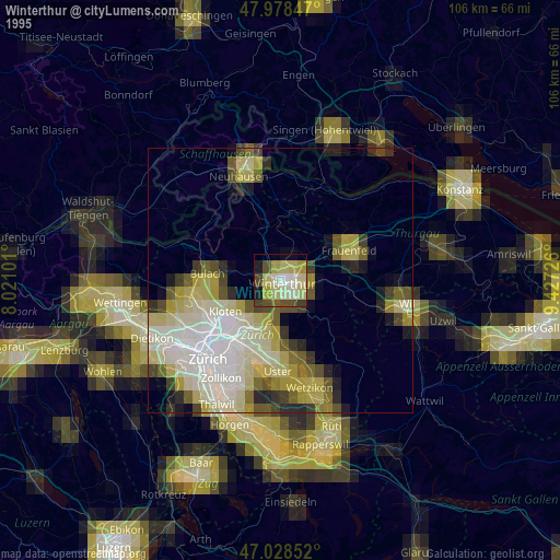
» NASA, Earths city lights 1995
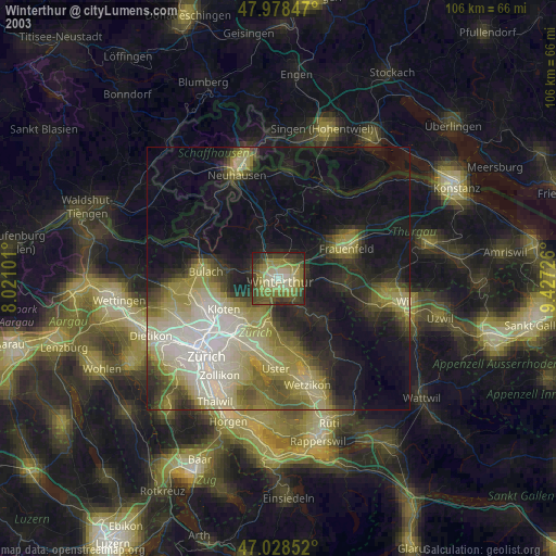
» NASA city lights 2003
» Earth at Night: Flat Maps 2012, 2016