Saint-Jérôme night lights from space
Night Light of Saint-Jérôme (Quebec) from space (Canada) Src. Average luminocity for 10x10km area is 62.1206% and for 50x50km: 23.4162%.
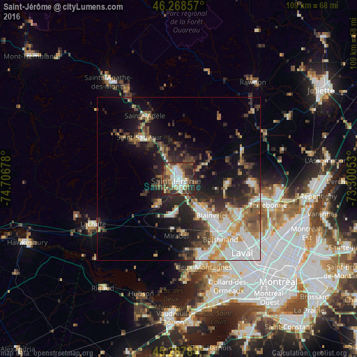
Analysis of Saint-Jérôme night lights 2016
Square area 10x10 km:
 12.86%
90-99
13.17%80-89
7.78%70-79
8.73%60-69
5.4%50-59
9.68%40-49
15.24%30-39
12.22%20-29
14.29%10-19
0.63%0-9
0%Square area 50x50 km:
4.78%90-99
4.31%80-89
2.18%70-79
2.58%60-69
2.6%50-59
2.99%40-49
4.1%30-39
3.87%20-29
6.86%10-19
11.14%0-9
54.59%Clear (daylight) street map image can be seen on geolist.org.
Map coordinates:
46° 16' 6.9" North, 74° 42' 24.4" West
45° 46' 49.3" North, 74° 0' 13.1" West
45° 17' 16.2" North, 73° 18' 1.9" West
Some cities around Saint-Jérôme sort by population:
• Blainville
15.7 km =9.8 mi,  143°
143°
• Mirabel
15.7 km =9.8 mi,  202°
202°
• Boisbriand
22.5 km =14 mi, 143°
• Deux-Montagnes
28.5 km =17.7 mi,  163°
163°
• Rosemère
22.8 km =14.2 mi, 135°
• Prévost
11.4 km =7.1 mi,  327°
327°
• Lorraine
20.3 km =12.6 mi,  122°
122°
• Bois-des-Filion
23.4 km =14.5 mi, 122°
6138501 (p: 54,948)
Sources (retrieved 2019-11-25):
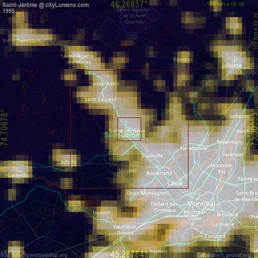
» NASA, Earths city lights 1995
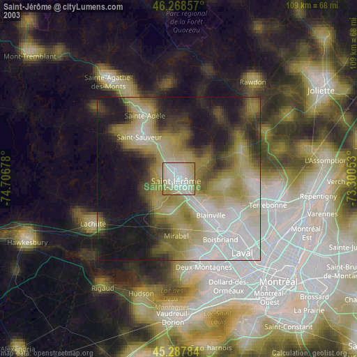
» NASA city lights 2003
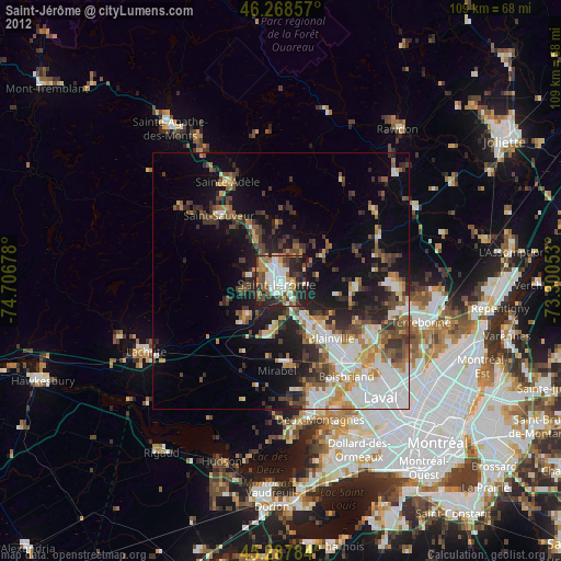
» Earth at Night: Flat Maps 2012, 2016