Boisbriand night lights from space
Night Light of Boisbriand (Quebec) from space (Canada) Src. Average luminocity for 10x10km area is 87.4333% and for 50x50km: 52.4187%.
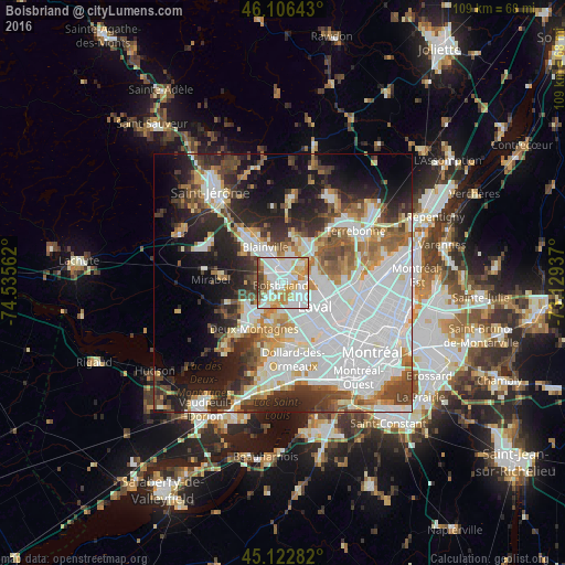
Analysis of Boisbriand night lights 2016
Square area 10x10 km:
 32.12%
90-99
27.58%80-89
14.39%70-79
9.7%60-69
7.12%50-59
3.94%40-49
4.39%30-39
0.76%20-29
0%10-19
0%0-9
0%Square area 50x50 km:
19.77%90-99
11.04%80-89
4.16%70-79
4.94%60-69
4.92%50-59
4.65%40-49
5.61%30-39
5.52%20-29
9.52%10-19
11.85%0-9
18.01%Clear (daylight) street map image can be seen on geolist.org.
Map coordinates:
46° 6' 23.1" North, 74° 32' 8.2" West
45° 37' 0.4" North, 73° 49' 57" West
45° 7' 22.2" North, 73° 7' 45.7" West
Some cities around Boisbriand sort by population:
• Laval
12.1 km =7.5 mi,  115°
115°
• Blainville
6.8 km =4.2 mi,  325°
325°
• Saint-Eustache
8.1 km =5 mi,  224°
224°
• Sainte-Thérèse
2.5 km =1.6 mi,  8°
8°
• Deux-Montagnes
10.6 km =6.6 mi,  210°
210°
• Rosemère
3.2 km =2 mi,  54°
54°
• Lorraine
8.4 km =5.2 mi,  27°
27°
• Bois-des-Filion
8.5 km =5.3 mi, 49°
5905132 (p: 26,483)
Sources (retrieved 2019-11-25):
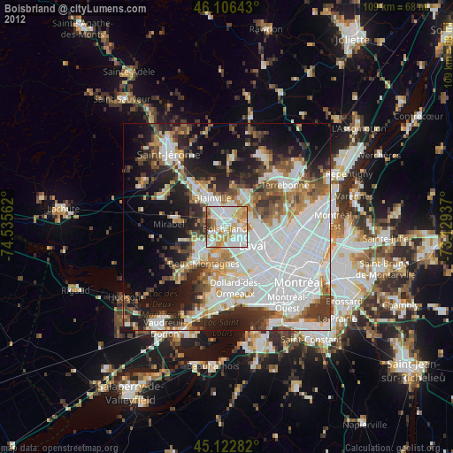
» Earth at Night: Flat Maps 2012, 2016