Laval night lights from space
Night Light of Laval (Quebec) from space (Canada) Src. Average luminocity for 10x10km area is 99.5303% and for 50x50km: 65.664%.
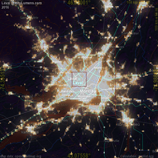
Analysis of Laval night lights 2016
Square area 10x10 km:
 83.18%
90-99
16.21%80-89
0%70-79
0.61%60-69
0%50-59
0%40-49
0%30-39
0%20-29
0%10-19
0%0-9
0%Square area 50x50 km:
24.48%90-99
15.78%80-89
5.33%70-79
6.31%60-69
6.35%50-59
5.71%40-49
6.62%30-39
7.09%20-29
10.26%10-19
9.75%0-9
2.31%Clear (daylight) street map image can be seen on geolist.org.
Map coordinates:
46° 3' 36" North, 74° 23' 42.5" West
45° 34' 11.8" North, 73° 41' 31.2" West
45° 4' 32.1" North, 72° 59' 20" West
Some cities around Laval sort by population:
• Montréal
10.6 km =6.6 mi,  129°
129°
• Saint-Laurent
8 km =5 mi,  165°
165°
• Saint-Léonard
7.8 km =4.8 mi,  75°
75°
• Côte-Saint-Luc
11.8 km =7.3 mi, 170°
• Mont-Royal
6.8 km =4.2 mi,  150°
150°
• Rosemère
10.9 km =6.8 mi,  310°
310°
• Bois-des-Filion
11.6 km =7.2 mi,  337°
337°
• Hampstead
10.2 km =6.3 mi, 167°
6050610 (p: 376,845)
Sources (retrieved 2019-11-25):
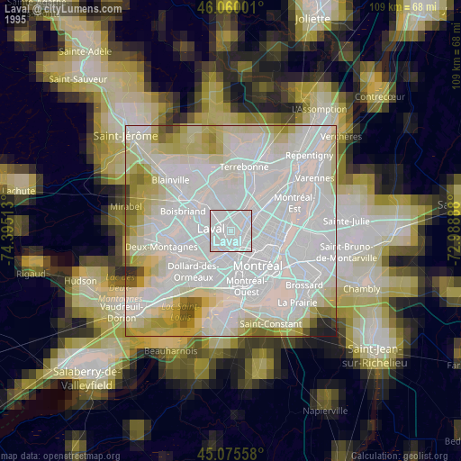
» NASA, Earths city lights 1995
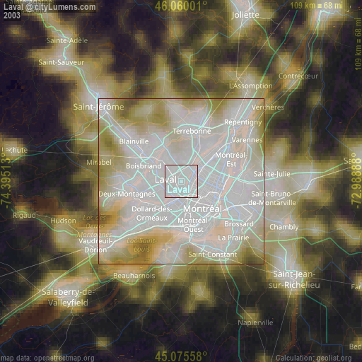
» NASA city lights 2003
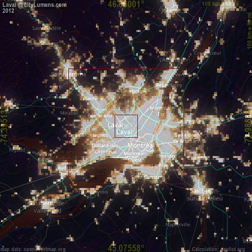
» Earth at Night: Flat Maps 2012, 2016